Land survey plan |


|
|
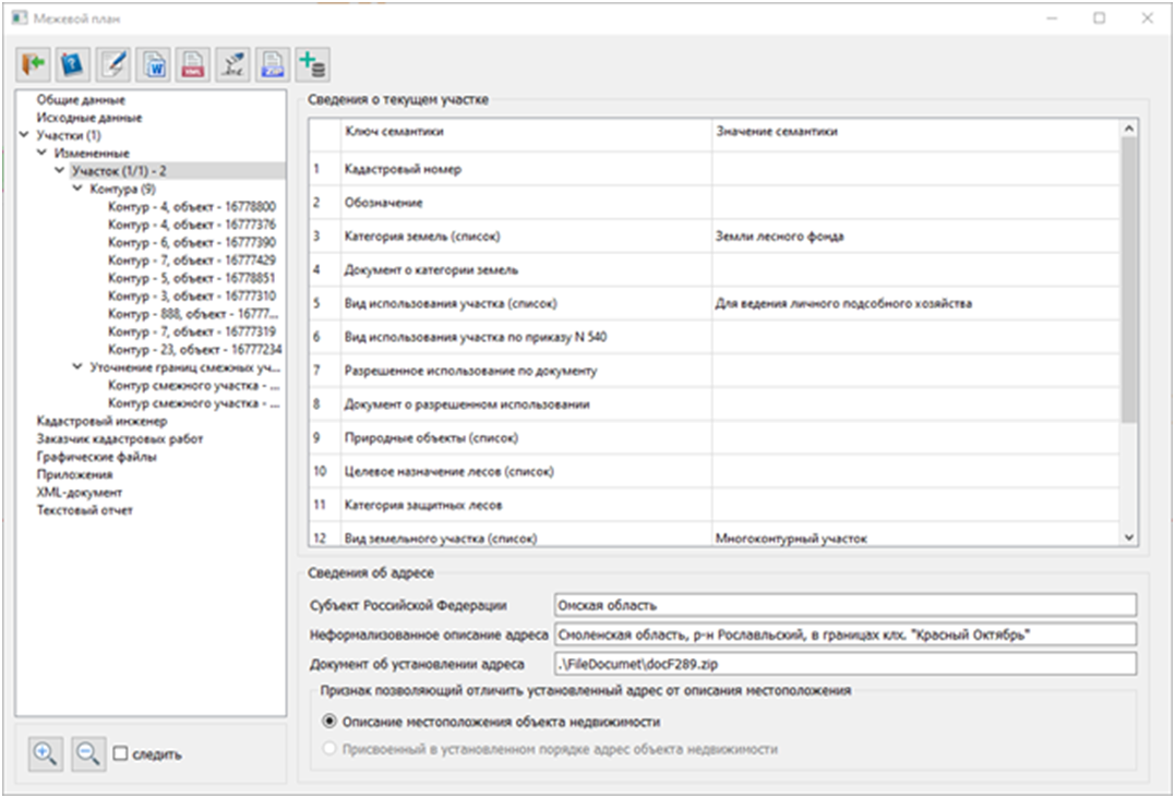
The dialog of the mode includes elements for displaying attribute data included in the text report and XML document. The data is structured in the form of a hierarchical tree corresponding to the sections of the boundary plan. The left part of the dialog displays the tree of sections, while the right part shows information for the selected node of the tree.
To create the document "Land survey plan", the user needs to perform the following technological steps:
1. Preparation of the cadastral plan map. 2. Preparation of graphic files with diagrams. 3. Input of information in the Base of cadastral works dialog. 4. Input of information in the Land survey plan dialog. 5. Formation of a textual report in the established format. 6. Formation of an electronic XML document in the established format.
The cadastral plan is a document compiled based on the cadastral plan of the corresponding territory or an extract from the Unified State Register of Real Estate (hereinafter referred to as the USRRE), including information about a specific land plot, which reproduces the data entered in the USRRE. For preparing the cadastral map of the USRRE, it is recommended to use the mode "Reading the cadastral plan of the territory and updating the map" and "Updating the Map".
Based on the USRRE map and materials from cadastral work, a cadastral plan map should be created, including: — Original land plots; — Formed land plots; — Modified land plots; — Formed and/or modified parts of land plots; — Characteristic points of the boundaries of cadastral objects.
Режим функционирует в виде диалога и обеспечивает ввод и редактирование сведений:
To prepare attributes of cadastral objects (plots and parts), the mode "Editing attributes of a cadastral object" is intended. This mode allows for the input and editing of information stored in the semantics of cadastral objects.
To prepare general information for the cadastral plan, elements in the Land survey plan dialog are used in conjunction with the Base of cadastral works. The mode "Base of cadastral works" is designed to display and maintain information necessary for filling out the general sections of the cadastral plan.
This mode operates as a dialog and facilitates the input and editing of information: — about the contract for conducting cadastral work; — about clients ordering cadastral work; — about measuring instruments; — about the geodetic basis used in preparing the cadastral plan; — about documents used in preparing the cadastral plan.
The entered information is saved in SQLite database tables. |
 To implement the requirements of the Rosreestr order dated December 14, 2021, No. P/0592 "On approval of the form and composition of data of a boundary plan, requirements for its preparation", the