Land survey plan. General information |


|
|
When selecting the General information node in the data tree, a query is made to the cadastral works database, and the elements of the dialog window are populated.
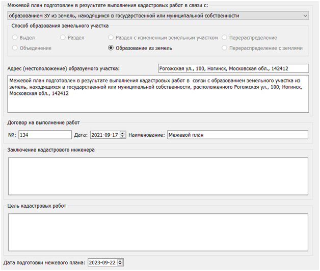
On the General information tab, information necessary for filling out the title details of the electronic document is entered.
The dropdown list in the Land survey plan block is prepared as a result of cadastral works related to: it is aligned with the value in the Land Plot Formation Method block. When a corresponding position is selected from the dropdown list, only available land plot formation methods are activated. At the same time, fields for entering attribute values are displayed or hidden: the number and cadastral numbers of plots, accounting numbers, and the address of the plot. Based on the values entered in the aforementioned fields, text is automatically generated and displayed in a separate text field. If necessary, the automatically generated text can be edited.
In the blocks for the Conclusion of the Cadastral Engineer and Purpose of Cadastral Works, relevant information is entered. The Conclusion of the Cadastral Engineer block is filled out in cases specified in paragraph 12 of the "Requirements..." approved by Order No. 412 of the Ministry of Economic Development dated November 24, 2008.
The information entered in the elements of the General Information dialog window is saved in the BKR. The saved information is used when reopening the dialog window, for filling out reports (the General information on cadastral work section), and for XML documents (the GeneralCadastralWorks element). |