Land survey plan. Initial data |


|
|
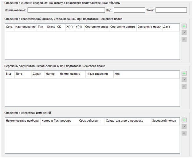
When selecting the Initial data node in the data tree, a query is made to the Cadastral works database, and the elements of the dialog window are populated.
On the Initial data tab, there are tables containing: — information about the coordinate system referenced by spatial objects (name, code, and zone number); — information about the geodetic basis used in the preparation of the cadastral plan; — information about the documents used in the preparation of the cadastral plan; — information about measuring instruments, which is intended for entering data about the devices and tools used to carry out cadastral works.
To the right of each table is a panel with a set of buttons that control the composition of the table rows: The Add button The Delete
The information entered in the fields of the Input Data node is saved in the corresponding Base of cadastral works tables. The saved information is used for subsequent openings of the dialog, to fill out reports (in the Initial data section), and for XML documents (in the InputData element).
|