Map (plan) of the object land 2024 |


|
|
At the same time, for 8 types of Objects, the formation of a textual report in the form of a map (plan) of the land management object is provided. The form of the map (plan) of the land management object is approved by the Resolution of the Government of the Russian Federation dated July 30, 2009, No. 621 (as amended by the Resolution of the Government of the Russian Federation dated May 17, 2016, No. 444, effective from June 1, 2016).
The prepared document in the form of a map (plan) of the land management object must be agreed upon by the relevant state or local authority and registered in the state data fund for land management. After registration in the fund, the map (plan) of the land management object must be submitted to the registration authority (Rosreestr) in the format of an electronic XML document. The requirements for the form and content of the electronic XML document are established by the XML schema interact_map_plan_v01_R04, approved by the order of Rosreestr dated December 25, 2023, No. P/0554.
The mode Map (Plan) of the Land Management Object ensures the formation of: — An XML document according to the schema interact_entry_boundaries_v02, — A textual report in the form of a Map (Plan) of the Land Management Object, — An XML document according to the schema interact_map_plan_v01_R04.
To create textual and electronic XML documents, the user needs to perform the following technological steps: 1. Preparation of the map of the land management object. 2. Filling in attributes of land management objects. 3. Preparation of graphic files. 4. Inputting information in the Base of cadastral works dialog. 5. Inputting information in the Map (Plan) of the Land Management Object dialog. 6. Formation of a textual report according to the established form. 7. Formation of an electronic XML document according to the approved schema.
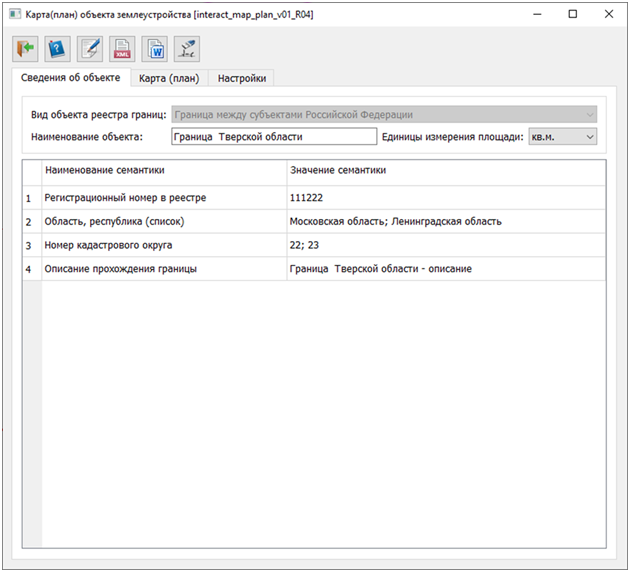
The dialog mode includes elements for displaying attribute information included in the textual report and XML documents. The information is organized in tabs to display corresponding groups of information.
The map (plan) of the land management object is a document that graphically and textually represents the location, size, and boundaries of the Object, as well as its other characteristics. The map (plan) of the land management object is prepared based on the results of describing the location of the boundaries of the Object, or parts of such boundaries, and/or establishing the boundaries of the Object, or parts of such boundaries, on the ground in accordance with the legislation of the Russian Federation. The results of establishing the boundaries of the Objects must be reflected on the map of the land management object.
To prepare the attributes of the objects, the mode Cadastral object attributes is intended. This mode allows for the input and editing of information stored in the semantics of the Objects. For preparing attribute information, the elements of the dialog Map (Plan) of the Land Management Object are intended to work in conjunction with the cadastral work database. The mode Base of cadastral works is designed to display and maintain the information necessary for filling out the title page, grounds for conducting land management work, and initial data. |
 By the Resolution of the Government dated December 31, 2015, No. 1532, the rules for submitting documents to the Unified State Register of Real Estate (EGRN) were established (hereinafter referred to as the Rules). The Rules provide for the submission of information about 21 types of land management objects (hereinafter referred to as Objects) in the form of electronic XML documents. The requirements for the form and content of the electronic XML document are established by the XML schema interact_entry_boundaries_v02, approved by the order of Rosreestr dated December 25, 2023, No. P/0554.
