Electronic XML document |


|
|
The mode is intended for generating an XML document for information interaction in maintaining the state real estate cadastre with the authorities of the subjects of the Russian Federation or local self-government bodies in terms of presenting the map (plan) of a land management object. The map (plan) always consists of one XML-file containing semantic information of the map (plan), as well as one or several PDF-files containing the graphic part of the map (plan) and appendices.
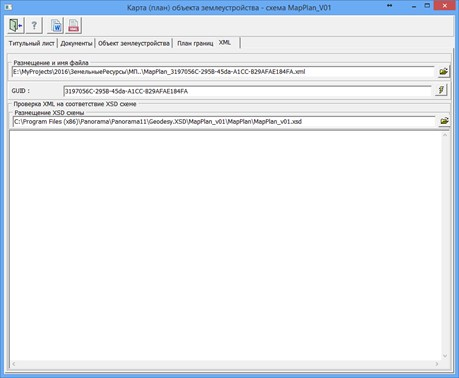
The name of the XML- file of the map (plan) is generated automatically, following the requirements of regulatory documents and has the following format: MapPlan_*.xml, where MapPlan is the prefix indicating the file with map (plan) information; * is a unique set of characters corresponding to a GUID.
The GUID is automatically generated and recorded in the XML file. The attached PDF-files should be located in the same folder as the XML file. The path to the attachment files is automatically specified in the XML document relative to the directory where the XML file of the map (plan) is located. Directory names and file names should not contain special characters such as: +/ \\ * < >@ « ” `] [ { } $ # ~.
Each XML and PDF file must be signed with its electronic signature. The electronic signature file should be placed in the same directory as the file being signed. The electronic signature file should be named: <name of the file being signed>.sig.
The generated XML-document of the map (plan) of a land management object is an integral part of the information provided to the state real estate cadastre during information interaction in the following cases: — Regarding information on establishing or changing boundaries between subjects of the Russian Federation, boundaries of municipal entities, boundaries of settlements (hereinafter referred to as Boundaries); — Regarding information on establishing, changing, or terminating the existence of areas with special conditions for land use, territorial zones (hereinafter referred to as Zones).
Within the framework of information interaction, XML-documents and attached PDF-files are packaged into a single ZIP package. The package contains one XML-file for Zones or Boundaries and one or several XML files of the map (plan), as well as PDF-files of the accompanying documents.
When creating an XML-document for the map (plan) of a land management object, the following information is used: — Information about customers of land management works; — Information about the performer of cadastral works; — Approvals of the map (plan) of the land management object; — Transmission of the map (plan) of the land management object to the state data fund; — Grounds for conducting land management works and initial data; — Information about the land management object; — Graphic images of the boundary plan of the land management object.
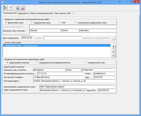
For ease of inputting attributes by sections of the XML document, indicators are grouped together. On the Title Page, sections Information about customers of land management works and Information about the performer of cadastral works are filled in.
The section Information about customers of land management works consists of a group List of customers and fields for entering data for one customer. The group List of customers displays a list of all customers.
To fill in the list of customers, you need to first enter information about one customer in the upper part of the dialog and click the button
Information about the performer of cadastral works is recorded in the corresponding group.
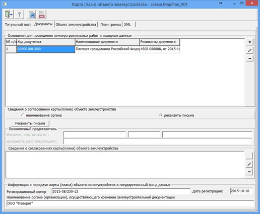
On the Documents page, a list of documents that serve as the basis for land management works and initial data is generated. To record lists of documents, you need to click the button
To fill in the list of approvals, you first need to enter information about one approval in the upper part of the Information on approvals for the cadastral map (plan) of land management object group and click the button . A new row will be automatically added to the Information on approvals for the cadastral map (plan) of land management object group. To edit a specific approval, you need to select the required row in the list, edit the data in the upper part of the dialog, and click the button
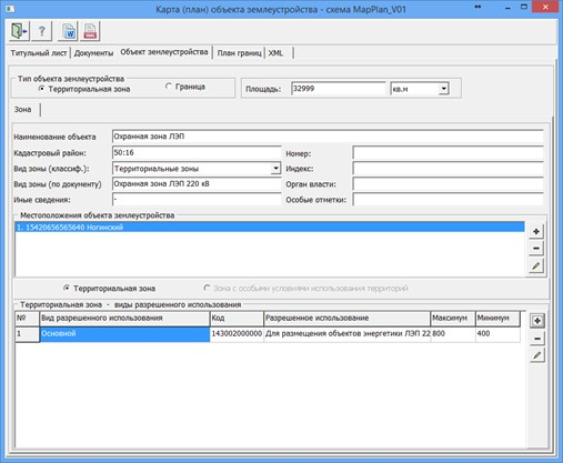
All fields are mandatory in the Information on transferring the cadastral map (plan) of the land management object to the state data fund obtained as a result of land management works group. On the Land Management Object page, information about the type of land management object and its attributes is entered according to the selected type: zones or boundaries.
For a land management object of the "Zone" type, the mandatory fields to fill in are: "Object Name," "Cadastre District," "Zone Type according to the classifier," "Number," and the section "Location of the land management object". The "Zone Type according to the classifier" is selected from the directory _Zone_v02.xsd .xsd. In the "Location of the land management object" section, the addresses of the object are recorded. To open a dialog to create a list of addresses, you can click the button
Entering information about the OKATO code or KLADR code is done through simple input of characters that characterize the corresponding code value of the all-Russian classifier. Another description of the location of cadastral work objects is used to enter information about the name of non-profit organizations or other informal descriptions of the location of the object.
For a "Territorial Zone", the mandatory element to fill in is Types of Permitted Use, with the required attribute to fill in being "Permitted Use". "Permitted Use (according to the classifier)" is filled from the directory dUtilizations_v01.xsd. For "Zones with Special Conditions for Land Use", the mandatory element to fill in is "Restrictions Content".
For a land management object of the "Boundaries" type, the mandatory element is "Object Name". To define boundaries between subjects of the Russian Federation, a list of adjacent subjects of the Russian Federation must be created in the table "Location of boundaries between subjects of the Russian Federation". For municipal entity boundaries or settlement boundaries, fill in the dialog Location of municipal entity boundaries, which is accessed by clicking
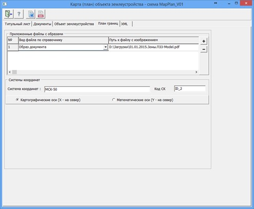
On the Boundary Plan page, a list of attached files is generated. A file is selected from the disk by clicking the button
|