Preparation of the land management map |


|
|
The preparation of the Land Management Object Map involves marking on the map the established and modified boundaries of the objects. If the boundary has been changed, it is also necessary to depict the original contours of the objects. The Land Management Object Map must be created according to the current version of the survey.rsc classifier. To map the results of cadastral work, objects from the "Cadastral Plan of the Territory" layer, as specified in the table below, are used.
To initiate the procedure for generating the report and XML document for the land management object map (plan), it is necessary to specify the contour of the real estate object on the map. The object-contour defines the coordinates of the boundaries (metric) of the land management object and its attributes (semantics). The object-contour is used when initializing the Dialogue Map (Plan) of the Land Management Object.
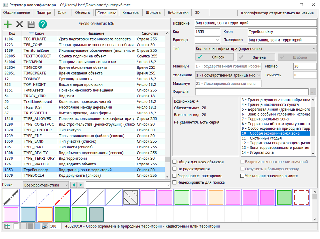
The selection of the map object type depends on the type of land management object. The required objects from the classifier are located in the "Cadastral Plan of the Territory" layer. When selecting the appropriate conditional sign, the necessary value corresponding to the type of boundaries, zones, and territories is automatically recorded in the semantics of the object "Type of Boundary" (TypeBoundary). If the semantics of TypeBoundary changes, the type of map object and its conditional sign will automatically change. The keys of the map object specified in the table are used to select the filled branch of the XML document.
Objects must have mandatory semantics filled out. The composition of mandatory semantics is determined based on the class of the object. The class is determined automatically by the program when entering attributes using the Cadastral object attributes.
When forming an object, the boundary of a new contour is applied to the map. The newly formed object must have its semantics "Marking" (MARKING) filled out. When changing (clarifying) the boundaries of an object, only the modified (clarified) contour is applied to the map. Exceptions are made for the "Boundary between subjects of the Russian Federation" (L_BORDER_RF) and "Boundary of a municipal formation" (L_BORDER_MUNIC). For these objects, in addition to the modified contour, it is necessary to apply the original (existing) contour or contours. The modified and original objects must have their semantics "Cadastral Boundary Number" (CULT_NUM) filled out. The value of the cadastral boundary number must match for both original and modified objects.
The newly formed, original, and modified (clarified) contours are applied with the same type of map object. After application, it is necessary to fill out the semantics "Status of Map Object" (STATUSOBJ) with the following values: 1. Existing — for the original contour; 2. Modified — for the modified contour; 3. New — for the newly formed contour; 4. Deleted — for the deleted contour.
If an Object has multiple external contours, each external contour is digitized as a separate map object. Internal contours — "holes" — are digitized as sub-objects. All external contours of one object are combined into a set of map objects using the mode To create a set: section and its external contours. If both original and modified objects are present on the map, two different sets of map objects are created. Each external contour is identified by a sequential contour number. To describe characteristic points of boundaries at metric nodes of object contours, point objects "Characteristic Point" (P0040000001) must be placed. The mode Creation of titles of rotary points of object is used for this purpose. For modified contours, it is additionally necessary to change the type of point objects for modified and deleted sections.
The expected result of mapping objects for various options of land management work is presented below.
I. Formation of the Object: 1. External contours of the formed Object of the required type from the table: a) All objects on the map have the same value for the semantics of Boundary, Zone, and Territory Type (TypeBoundary); b) All objects on the map have a semantic value of Map Object Status (STATUSOBJ) = 3; 2. Point objects Characteristic Point (P0040000001) at all nodes of the Object metric.
II. Modification of the Object: 1. Existing (initial) Object: a) External contours of the Object of the required type from the table. b) For all objects on the map (external contours): — The semantics of Boundary, Zone, and Territory Type (TypeBoundary) have the same value; — The semantic value of Map Object Status (STATUSOBJ) = 1; — The semantic value of Registry Number (CULT_NUM) has the same value; — If the Object has multiple external contours, then for all objects on the map, the semantic value of Accounting Number (PART_NUMB) is filled with unique values from 1 to N, where N is the number of external contours; c) Point objects Characteristic Point (P0040000001) at all nodes of the metric of the existing Object.
2. Modified (Clarified) Object: a) External contours of the Object of the required type from the table; b) For all objects on the map (external contours): — The semantics of Boundary, Zone, and Territory Type (TypeBoundary) has the same value corresponding to the value of the existing Object; — The semantic value of Map Object Status (STATUSOBJ) = 2; — The semantic value of Registry Number (CULT_NUM) has the same value corresponding to the value of the existing Object; — If the Object has multiple external contours, then for all objects on the map, the semantic value of Accounting Number (PART_NUMB) is filled with unique values from 1 to N, where N is the number of external contours corresponding to the values of the contours of the existing Object; c) Point objects: — Characteristic Point (P0040000001) at all nodes of the metric of the modified (clarified) Object; — Characteristic Point Clarified (Start) (START_CHANGE) at the nodes of the beginning of the modified section; — Characteristic Point Clarified (End) (END_CHANGE) at the nodes of the end of the modified section; — Characteristic Point Deleted (Start) (START_DELETE) at the nodes of the beginning of the deleted section; — Characteristic Point Deleted (End) (END_DELETE) at the nodes of the end of the deleted section; d) Linear objects: — Clarified Boundary (LINE_CHANGE) between pairs of points START_CHANGE and END_CHANGE; — Deleted Boundary (LINE_DELETE) between pairs of points START_DELETE and END_DELETE.
For Objects such as Boundary between subjects of the Russian Federation (L_BORDER_RF) and Boundary of a municipal entity (L_BORDER_MUNIC), it is not necessary to mark modified and deleted sections with characteristic points, as their original (existing) contour or contours are applied.
Modified sections of the metric are marked with point objects: — Characteristic Point Clarified (Start) (START_CHANGE) — beginning of the modified section; — Characteristic Point Clarified (End) (END_CHANGE) — end of the modified section; — Characteristic Point Deleted (Start) (START_DELETE) — beginning of the deleted section; — Characteristic Point Deleted (End) (END_DELETE) — end of the deleted section.
When clarifying (modifying) part of a boundary contour, the coordinates of existing points should be used as the first and last points of the modified section. The modification of part of the contour will occur within the range of points defined by START_CHANGE and END_CHANGE. For better visual perception, a linear object Clarified Boundary (LINE_CHANGE) may additionally be applied to the segment of the metric between points START_CHANGE and END_CHANGE.
When deleting part of a contour, the coordinates of existing points should also be used as the first and last points of the modified section. The deletion of part of the contour will occur within the range defined by START_DELETE and END_DELETE. For better visual perception, a linear object Deleted Boundary (LINE_DELETE) may additionally be applied to the segment of the metric between points START_DELETE and END_DELETE.
If characteristic points have already been placed, their type should be changed to START_CHANGE, END_CHANGE, START_DELETE, or END_DELETE, taking into account the modified and deleted sections of the Object's metric. There should be only one point object — a characteristic point — at any point in the metric of the Object.
If all characteristic points of different types are placed correctly, then the number of Clarified Boundary objects should correspond to the number of pairs of points START_CHANGE and END_CHANGE. The number of Deleted Boundary objects should correspond to the number of pairs of points START_DELETE and END_DELETE.
The preparation of a land management object map depends on the type of land management object: State border of the Russian Federation Border of a subject of the Russian Federation Border of a municipal formation Border of a populated locality Shoreline (border of a water body) |