Lists of objects

Print Previous page Top page Next page

ic_0233 This mode are intended for saving criteria of marking objects of a map. Criteria are set by the filter or an any set of objects for all map sheets of the document. Lists of objects are saved in a file with OBX extension. The name of a file is formed by name a file of the basic document and is located in LOG subdirectory.

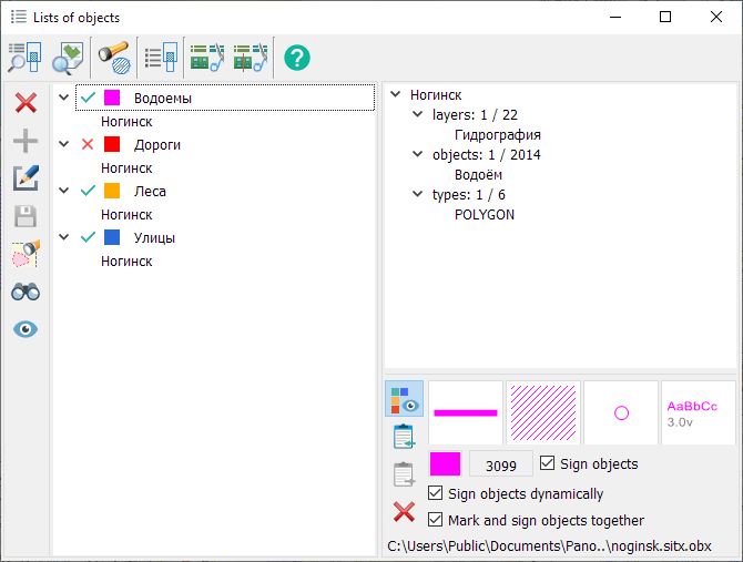
Data of lists file can be used for an execution of operations above sets of objects: selection, union, intersection, search, signing and others.


clip0031


Modes for creating and editing lists of objects


Безымянный35

Add list

The mode is intended for adding selected objects into the list.

Безымянный43

Delete list

The mode is intended for deleting a list of objects.

Безымянный56

Change list composition (Update)

The mode is intended for changing the composition of the list of objects. For this it is necessary:

1.Click on the button Безымянный56 (dialog will temporarily collapse to the bottom of the application).

2. Select objects using one of the modes of the main application panel, or a combination of them:Безымянный57Безымянный59Безымянный60 Безымянный61Безымянный62Безымянный47

3. Expand the dialog.

4.Release the button Безымянный56.

Безымянный48

Save

The mode is intended for saving changes into a file of object lists.

Безымянный47

Mark objects

The mode is designed to mark list objects on the map.

Безымянный46

Find objects

The mode is designed for finding list objects on the map.

Безымянный58

View objects

The mode is intended for setting the objects of the list into the map display composition. To restore the display composition, you need to release the mode Безымянный58.

vcb

Save labeling parameters in XML

The mode is designed to save the list of maps to be labeled.


Editing the name of the list is carried out by clicking LMB in the tree of object lists.

SPOB2

Operations on lists of objects


Безымянный49

Finding intersections

The mode is intended for searching/selecting objects from «List 2» according to «List 1»

Безымянный50

Find nearest neighbors for list objects

The mode is intended for finding the nearest object from the control list for each object from the analyzed list.

Безымянный51

Building a buffer zone around list objects

he mode is designed to build a zone around list objects.

Безымянный55

Union/crossing of the sets

The mode is intended for uniting objects or constructing areas of intersection of objects.

Безымянный54

Cutting objects from the list

The mode is intended for cutting list objects.

Безымянный53

Splitting objects by the list

The mode is intended for splitting list objects.

Безымянный52

Help

Calling help


Creating and editing thematic layers


When creating a list of objects, a thematic layer is automatically formed with a set of conventional symbols for localization: areal, linear and vector (point).


There are 3 ways to assign a thematic layer view:

1. Default view, with the ability to change colors. A set of conventional symbols and color are formed automatically.

2. The view assigned in the map classifier, with the ability to replace the color. It is set using the Display as object view mode.

3. Custom view. Set using the Editing styles mode.


In order to change the color of conventional symbols, in the tree of object lists, click LMB in the area of the icon with the color.


SPOB4

The title of the thematic layer contains the name of the list and map. For example, List [Noginsk].


Labeling List Items


This mode is designed for labeling list items based on their semantic characteristics.


To label a list, follow these steps:

1. Enable the «Sign Objects» mode.


2. Choose a semantic characteristic. By default, the semantic «Proper Name» is selected. Hovering over the semantic code will display the name of the semantic characteristic in a tooltip.


To select a semantic characteristic, click the left mouse button in the area displaying the semantic code . In the «Semantics choice» dialog, you can choose the appropriate semantic for labeling.


If the object being labeled lacks a selected semantic or has no value, the object will not be labeled. The labeling style can be set by default, with color replacement, similar to thematic layers, or have a custom appearance. This is configured in the Editing styles mode. When the semantic code, color, or labeling style is changed, a relabeling of the list of objects is performed. Simultaneously displaying objects in lists with symbolic signs and labeling based on semantics is possible.


Dynamic Labeling of List Objects


This mode allows you to apply labels on top of the map taking into account the current map display and visibility of objects. Dynamic labeling is performed based on the dimensions of the client area of the window. To improve readability when scaling the map, such labels are always drawn while maintaining the font height selected by the user. When labeling an area object, the label is placed in the visible part of the polygon being labeled. When scrolling the map image, the label automatically shifts so that its text fits entirely within the client area of the window.

For curved labels, it is not recommended to choose a background. It is recommended to choose highlighting around characters (Narrow outline).


To dynamically label list objects, you need to:

- set the mode to Label Objects

- select a semantic characteristic for labeling

- set the mode to Label Objects dynamically


Example of dynamic labeling of lakes, streets, and highways


vcbjk


Example labeling streets based on the semantic characteristic "OSM Identifier"


Modes for creating and editing thematic layers


Безымянный29

Enable/Disable display of custom styles

The mode is designed to enable or disable the display of thematic layers on the map. By default, the visibility of the thematic layer is disabled. To include a thematic layer in the data and set its visibility, you need to run the «Map Legend» task and go to the «General data list» tab

Безымянный20

Безымянный30

Assign a custom style

The mode is intended for assigning a custom view to a list of objects.

Безымянный31

Clear list of custom styles

The mode is designed to remove the custom view for the list of objects.


Composition of the list of objects

Information about the composition of the list is presented in the form of a map tree with a description of the total and used number of objects, layers, localizations, semantics, measurements and formulas.


Examples of describing the composition of a list of objects


The filter of list objects by layers, types (localizations) and object type from the classifier

The total and used number of object types, localizations and layers is indicated.

If a node with a map does not contain child elements (or has a limited composition), then the filter contains all layers, all localizations and all types of objects.

Безымянный23

Filter by list of objects

The total and used number of objects is indicated.

Безымянный24

Filter by name in semantics

The name or list of names, the condition and the name of the semantics are indicated.

Безымянный25

Filter by formulas

The formula, range of values and condition are specified.

Безымянный26

Filter by semantics

The name, semantics value and condition are specified.

Безымянный27

Filter by measurements

The measurement type, value range and condition are specified.

Безымянный28