Dynamic labeling of list objects |


|
|
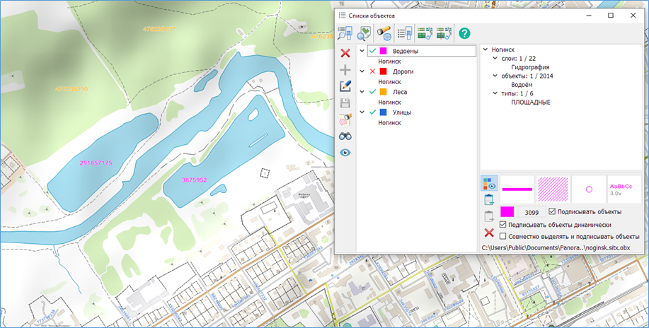
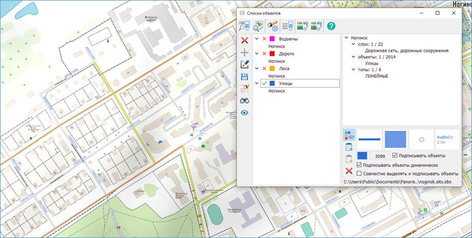
This mode allows for placing labels on the map, taking into account the current display composition of the map and the visibility of objects. Dynamic labeling is performed based on the dimensions of the client area of the window. To enhance readability when zooming in on the map, these labels are always drawn while maintaining the font size chosen by the user. When labeling a polygonal object, the label is placed within the visible part of the polygon being labeled. When scrolling the map image, the label automatically shifts to ensure that its text remains entirely within the client area of the window.
For curved labels, it is not recommended to choose a background. It is advisable to select highlighting around the symbols (Narrow contour).
For dynamic labeling of objects in the list:
1. Enable the Label Objects mode.
2. Select a semantic characteristic for labeling.
3. Enable the Dynamic Labeling mode.
Example of dynamic labeling for lakes, streets, and highways.
Example of labeling streets by the semantic characteristic "OSM Identifier"
|


