Definition of structure of the TIFF (GeoTIFF) file |


|
|
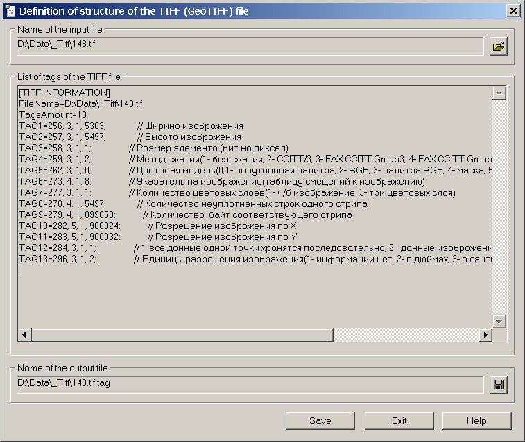
The mode is intended for reading tags of a file of TIFF format. The file of TIFF format consists of tags. Tags - blocks of data containing information about the size of the image, its color model, the size of the palette (the number of used colors), data compression, etc. By means of special tags the information about a geospatial binding of the image of TIFF file is transmitted. Files *.tif, containing the information about the geospatial binding of the image, have received name GeoTIFF. The mode does not support BigTIFF format files. To save the information on tags of the chosen file of TIFF format into a text file, use the button «Save».
Way of starting the mode «Definition of structure of the TIFF (GeoTIFF) file»: 1.Make active dialog «Run Application» (Tools\Run Application). 2.In dialog «Run Application» find the theme «Import/export of data (in addition to the File menu)». 3.Highlight the section «Print of GeoTIFF tags into a text file for viewing». 4.Click on the «Run» button of the «Run Application» dialog.
Examples of GeoTIFF file tag sets:
Structure of GeoTIFF file in Lat/Lon projection (EPSG code 4326). Structure of GeoTIFF file in the projection specified by a set of parameters.
|