Structure of GeoTIFF file in the projection specified by a set of parameters

Print Previous page Top page Next page

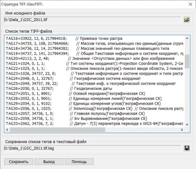
Viewing tags of a GeoTIFF file with a projection specified by a set of parameters:


taglist2


[TIFF INFORMATION]


FileName=D:\Data_1\GSC_2011.tif


TagsAmount=46


TAG1=256, 3, 1, 8286;

// Image width

TAG2=257, 3, 1, 8768;

// Image height

TAG3=258, 3, 3, 217955214;

// Element size (bits per pixel)

TAG4=259, 3, 1, 1;

// Compression method(1- without compression, , 2- CCITT/3, 3- FAXCCITTGroup3, 4- FAXCCITTGroup4, 5- LZW, 32773- PackBit)

TAG5=262, 3, 1, 2;

// Color model(0.1- halftone palette, 2- RGB, 3- RGB palette, 4- mask, 5- CMYK)

TAG6=273, 4, 1096, 217959604;

// Pointer to the image (table of offsets to the image)

TAG7=277, 3, 1, 3;

// Number of color layers(1- b/w image, 3- three color layers)

TAG8=278, 3, 1, 8;

// Number of uncompressed lines of one strip

TAG9=279, 4, 1096, 217955220;

// The number of bytes of the corresponding strip

TAG10=282, 5, 1, 217955198;

// Image resolution in Х

TAG11=283, 5, 1, 217955206;

// Image resolution in Y

TAG12=284, 3, 1, 1;

// 1 - all data of one point is stored sequentially, 2 - image data is divided into planes and stored layer by layer

TAG13=296, 3, 1, 2;

// Image resolution units (1 - no information, 2 - in inches, 3 - in centimeters)

TAG14=339, 3, 3, 217963988;

// Description of the data definition scheme (1-shortint, 2-longint, 3-float, 4-undefined data format)

TAG15=33550, 12, 3, 217963994;

// The size of the raster point in X,Y,Z

TAG16=33922, 12, 6, 217964018;

// Binding a raster point

TAG17=34735, 3, 108, 217964066;

// Array of tags describing geo-data (data is grouped into quadruples)

TAG18=34736, 12, 14, 217964282;

// Array of geo-data values of floating type

TAG19=34737, 2, 141, 217964394;

// General textual information about the coordinate system, projection, ellipsoid ...

TAG20=42113, 2, 2, 48;

// The value of <No data> or the background of the image

TAG21=1024, 0, 1, 1;

// Type of coordinate system(1-Projection Coordinate System, 2-Geographic latitude-longitude System, 3-Geocentric (X,Y,Z) Coordinate System)

TAG22=1025, 0, 1, 1;

// Raster pixel description (1-pixel as an area, 2-pixel as a point)

TAG23=1026, 34737, 22, 0;

// Text information about the coordinate system and raster pixel type

TAG24=2048, 0, 1, 32767;

// Geographic coordinate system

TAG25=2049, 34737, 39, 22;

// Text info. about the geographic coordinate system

TAG26=2050, 0, 1, 32767;

// Geodetic dates

TAG27=2051, 0, 1, 8901;

// Axial meridian(Geographical CS)

TAG28=2052, 0, 1, 9001;

// Units of lines measurement(Geographical CS)

TAG29=2054, 0, 1, 9102;

// Units of angles measurement(Geographical CS)

TAG30=2056, 0, 1, 1025;

// Ellipsoid (Geographical CS) // Description of the raster pixel (1-pixel as an area, 2-pixel as a point)

TAG31=2057, 34736, 1, 0;

// Main half-axis(Geographical CS)

TAG32=2059, 34736, 1, 1;

// Inv Alignment(Geographical CS)

TAG33=2062, 34736, 7, 2;

// Datum - 7(3) parameters for transition to WGS-84(Geographical CS)

TAG34=3072, 0, 1, 32767;

// Projection parameters

TAG35=3073, 34737, 71, 61;

// Text information about Projection parameters

TAG36=3074, 0, 1, 32767;

// Description of the projection

TAG37=3075, 0, 1, 1;

// ProjCoordTrans

TAG38=3076, 0, 1, 9001;

// Units of measurement of lines(Description of the projection)

TAG39=3080, 34736, 1, 9;

// ProjOriginLong

TAG40=3081, 34736, 1, 10;

// ProjOriginLat

TAG41=3082, 34736, 1, 11;

// ProjFalseEasting

TAG42=3083, 34736, 1, 12;

// ProjFalseNorthing

TAG43=3092, 34736, 1, 13;

// ProjScaleAtOrigin

TAG44=4096, 0, 1, 32767;


TAG45=4097, 34737, 8, 132;


TAG46=4099, 0, 1, 9001;


[GeoTIFF INFORMATION]

FileName=D:\Data_1\GSC_2011.tif

GTModelTypeGeoKey[1024]=1,

GTRasterTypeGeoKey[1025]=1,

GeographicTypeGeoKey[2048]=32767,

GeogCitationGeoKey[2049]=Primary ref. system Generated geodetic

GeogGeodeticDatumGeoKey[2050]=32767,

GeogPrimeMeridianGeoKey[2051]=8901,

GeogLinearUnitsGeoKey[2052]=9001,

GeogAngularUnitsGeoKey[2054]=9102,

GeogEllipsoidGeoKey[2056]=1025,

GeogSemiMajorAxisGeoKey[2057]=6378136.500000,

GeogInvFlatteningGeoKey[2059]=298.256415,

GeogTOWGS84GeoKey[2062]dX=0.013000,

GeogTOWGS84GeoKey[2062]dY=-0.092000,

GeogTOWGS84GeoKey[2062]dZ=-0.030000,

GeogTOWGS84GeoKey[2062]Rx=-0.001738,

GeogTOWGS84GeoKey[2062]Ry=0.003559,

GeogTOWGS84GeoKey[2062]Rz=-0.004263,

GeogTOWGS84GeoKey[2062]dS=0.007400,

ProjectedCSTypeGeoKey[3072]=32767,

ProjectionGeoKey[3074]=32767,

ProjectionGeoKey[3075]=1,

ProjLinearUnitsGeoKey[3076]=9001,

ProjOriginLongGeoKey[3080]=93.000000,

ProjOriginLatGeoKey[3081]=0.000000,

ProjFalseEastingGeoKey[3082]=16500000.000000,

ProjFalseNorthingGeoKey[3083]=0.000000,

ProjScaleAtOriginGeoKey[3092]=1.000000,

VerticalCSTypeGeoKey[4096]=32767,

VerticalUnitsGeoKey[4099]=9001,

ModelPixelScaleTag[33550]ScaleX=0.089854,

ModelPixelScaleTag[33550]ScaleY=0.089854,

ModelPixelScaleTag[33550]ScaleZ=0.000000,

ModelTiepointTag[33922]I[0]=0.000000,

ModelTiepointTag[33922]J[1]=0.000000,

ModelTiepointTag[33922]K[2]=0.000000,

ModelTiepointTag[33922]X[3]=16602699.440851,

ModelTiepointTag[33922]Y[4]=5673212.685212,

ModelTiepointTag[33922]Z[5]=0.000000,

GeoDoubleParamsTag[0]=6378136.500000

GeoDoubleParamsTag[1]=298.256415

GeoDoubleParamsTag[2]=0.013000

GeoDoubleParamsTag[3]=-0.092000

GeoDoubleParamsTag[4]=-0.030000

GeoDoubleParamsTag[5]=-0.001738

GeoDoubleParamsTag[6]=0.003559

GeoDoubleParamsTag[7]=-0.004263

GeoDoubleParamsTag[8]=0.007400

GeoDoubleParamsTag[9]=93.000000

GeoDoubleParamsTag[10]=0.000000

GeoDoubleParamsTag[11]=16500000.000000

GeoDoubleParamsTag[12]=0.000000

GeoDoubleParamsTag[13]=1.000000