Connection of tile/raster data from WMS/WMTS services |


|
|
Opening in a separate window or adding data from arbitrary geoportals not included in the menu is possible using the button on the main panel Maps from WMS/WMTS-server.
Connecting to the WMS/WMTS service
Opening the data in a separate window or adding it from arbitrary geoportals is possible by using the menu File → Geoportals → Map from WMS/WMTS-server (for access to images - tiles and semantic data); Map from WFS-server (for access to vector and semantic data); Map from the WCS-server (for access to matrixes of heights, matrixes of quality or geo-coverage). To open it in a separate window, click the Set button. To add to existing data, click the Add button.
Loading data from the WMS/WMTS geoportal
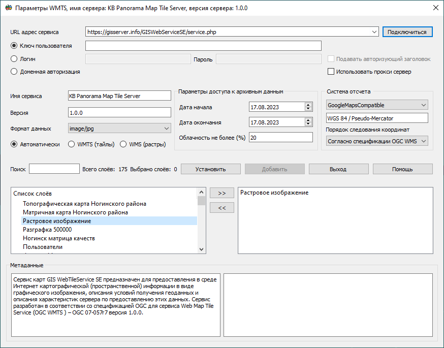
To open data from the geoportal in the dialog, you need to perform the following steps: 1) In the dialog, in the URL address field, specify the server URL (for example, https://gisserver.info/GISWebServiceSE/service.php). 2) Click on the Connect button. 3) Select the required data from the list of layers by selecting the layer and clicking on the «>>» button or double-clicking on the required layer in the list. 4) Click on the Add or Set button to start the process of displaying spatial information from the server.
Combining a vector map and data from the Yandex geoportal
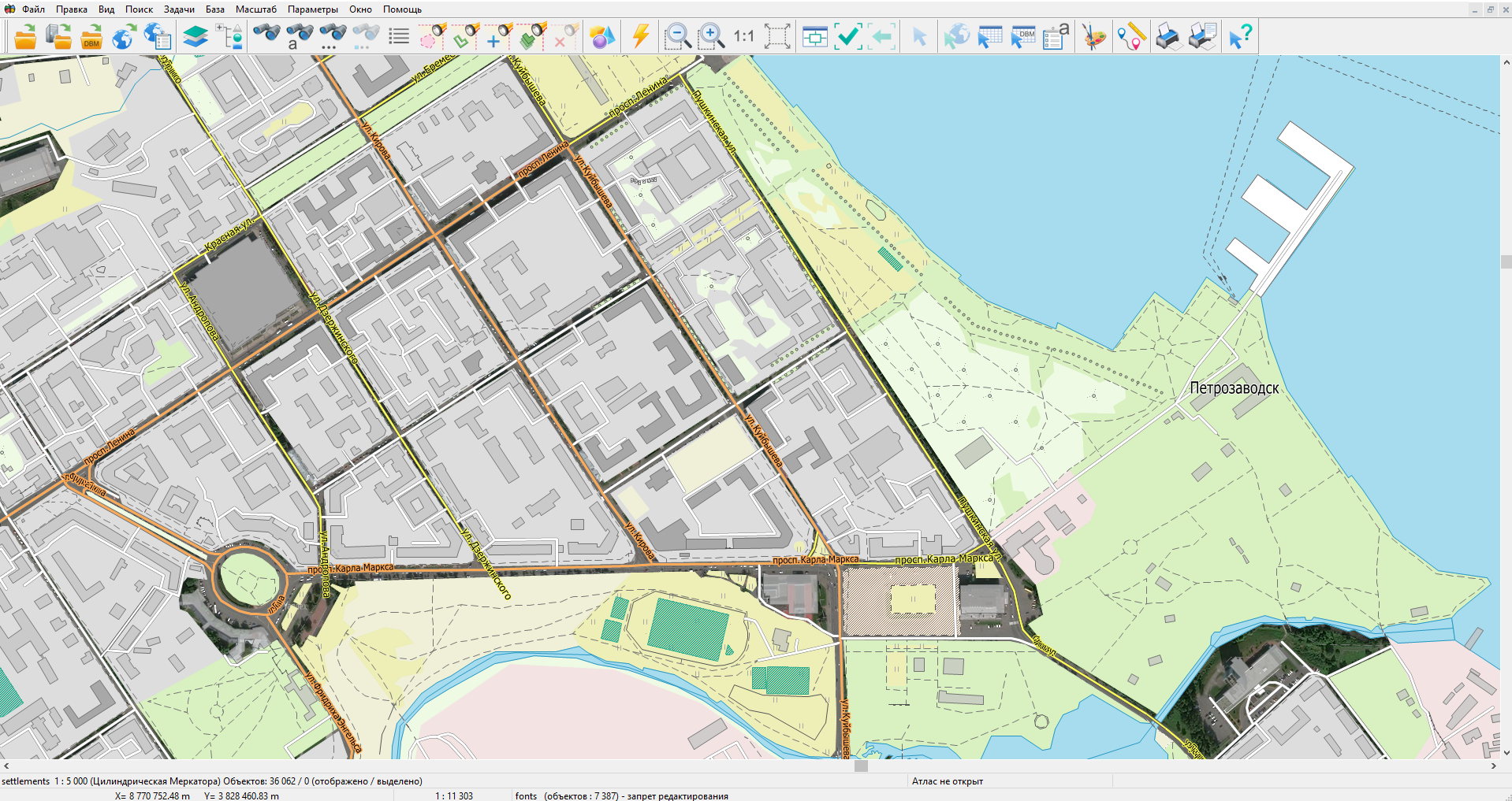
It is possible to combine different types of data: geoportals, vector data, matrix data, raster information.
To delete data from the list, you must click on the << button or double-click on the required layer in the list in the right field. To select the format of the loaded data, in the Data format field, select the required format. In this format, tiles will be saved in a folder for storing geoportal data for further offline use.
By default, when connecting to a geoportal, the dialog automatically tests the connection type and connects using the standard WMTS(tiles); if it is not available, it tries to connect using the standard WMS(rasters). But the user can choose the connection standard he is interested in by selecting the WMTS(tiles) or WMS(rasters) property.
The user can select a reference system that allows you to set the data projection and scale range for displaying the data. To do this, you need to select the reference system of interest in the CRS list. The reference system affects the speed at which data is displayed. If the selected projection coincides with the projection of the map or raster data, then the display speed is maximum. When adding data, the geoportal always converts open data to its projection. To reset the projection to the initial state it is necessary to press the Reset button in the Options → Current projection menu. Some geoportals can provide information with their own coordinate order. If the user, when connecting a geoportal, sees that the picture is displayed on the wrong area, but with inverted axis values, then for this, when connecting, it is necessary to specify the Coordinate order → Latitude/Longitude or Longitude/Latitude. And repeat the procedure for opening the data again.
Some geoportals allow access to archived data or access to satellite images with a certain percentage of cloudiness. To do this, you need to select the required ranges of start and end dates, and also set the Cloudiness parameter.
For user convenience, a quick search (navigation) has been added through the list of layers available on the server. To do this, in the Search field, the user must enter the first letters of the name of the layer he is interested in and the list will automatically go to the layers of interest to him.
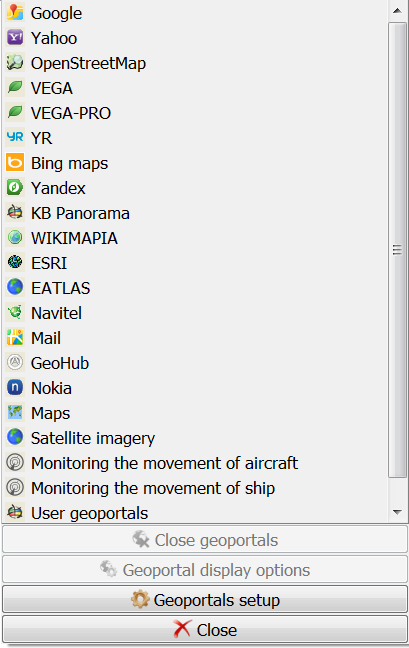
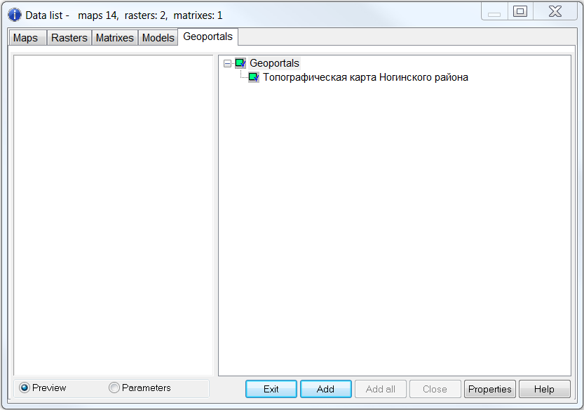
For ease of use and reconnection (if it is not in the list of geoportals), the connected geoportal is added into the List of geoportals menu into the section - User geoportals, as well as onto the tab the Data List → Geoportals.
User geoportal
Data list |