Geoportals setup |


|
|
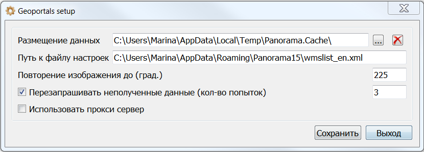
All data received from geoportals is saved in the folder of geoportals data location. To configure it, you need to specify the path to the data in the Data location field.
Parameter the Image repetition is necessary for continuous viewing of data at the border of 180 deg. or at -180 deg. (for example Kamchatka). Acceptable values are from 180 to 360.
If the server does not respond to the request, or the connection timeout has expired, the data may not be received. This may be expressed in missing image tiles onto some areas. To guarantee the receipt of data, use the parameter that sets the number of attempts when sending an unsuccessful request - To re-request unreceived data.
General parameters of the geoportal
|