The procedure for connecting an arbitrary geoportal according to the TMS standard |


|
|
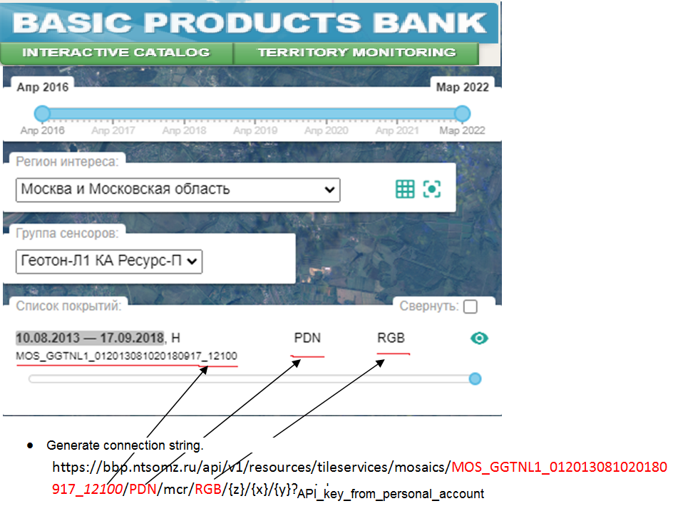
The procedure for connecting an arbitrary geoportal according to the TMS standard on the example of the Basic Products Bank of Russian Space Systems (RSS). 1. Get an API key in your personal account. 2. Go to the website of the Basic Products Bank of RSS https://bbp.ntsomz.ru/bsp/ 3. Pass the authentication procedure. 4. Select region of interest, select sensor group, select coverage of interest.
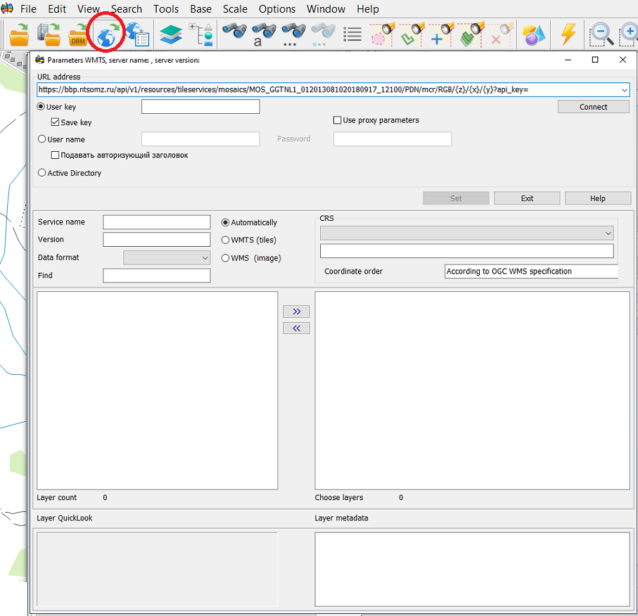
5. Open GIS Panorama. 6. Click on the Open map from WMS-server button. 7. Enter the generated string into line the URL address of the server. 8. Click on the Connect button. 9. Double click on the geoportal in the list of layers. 10. Click the Set button.
To add the indicated layer into the drop-down list of geoportals, do the following: 1. Open the settings file c:\Program Files\Panorama\Panorama14\wmslist_en.xml 2. Into the Portal node, add the section:
<Topic Link="wmslist\temp.bmp" Name="Банк базовых продуктов РКС"> <Layer Name="Покрытие1" UnicId="RKS_SAT"> <ConnectedSting> <URL><![CDATA[https://bbp.ntsomz.ru/api/v1/resources/tileservices/mosaics/MOS_GGTNL1_012013081020180917_12100/PDN/mcr/RGB/]]></URL> <AdditionalRequest><![CDATA[?api_key=api_key_from_personal_account]]></AdditionalRequest> <ID Number="1" Value="RKS_SAT"/> <Name Number="1" Value="RKS_SAT"/> <Matrix Name="GoogleMapsCompatible"/> </ConnectedSting> <PortalStadndart>UTMS</PortalStadndart> <Alghoritm>1</Alghoritm> <Transparent>0xFFFFFFFF</Transparent> <ShowColor>0</ShowColor> <ShiftX>0</ShiftX> <ShiftY>0</ShiftY> <Point X="55.94448244" Y="38.21196422"/> </Layer> </Topic>
3. Save changes. 4. Start the Panorama. 5. Click button the Select geoportal from the list. 6. Answer Yes to the question about replacing the file. 7. The added node will appear in the drop-down list of geoportals.
|


