Connection of geoportal |


|
|
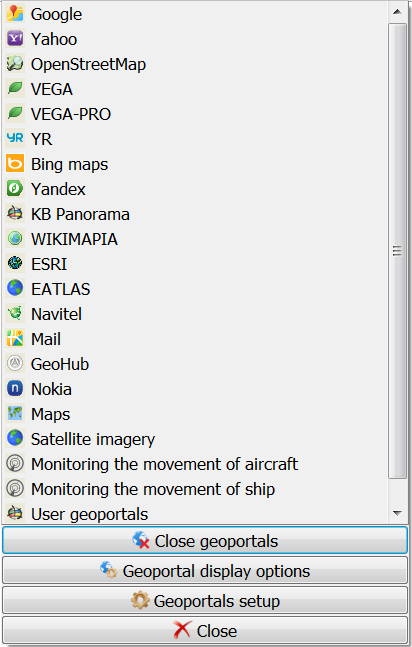
A geoportal can be connected through the geoportals menu, which is opened through the button on the main panel «Show geoportal list».
The program supports 35 data request formats for geoportals, 9 standard international matrices, more than 5,000 projections defined by the EPSG code. The standard menu includes 39 geoportals, 151 data layers. The list of supported request formats and the composition of the geoportals menu is given in the wmslist_ru.xml configuration file.
Geoportals
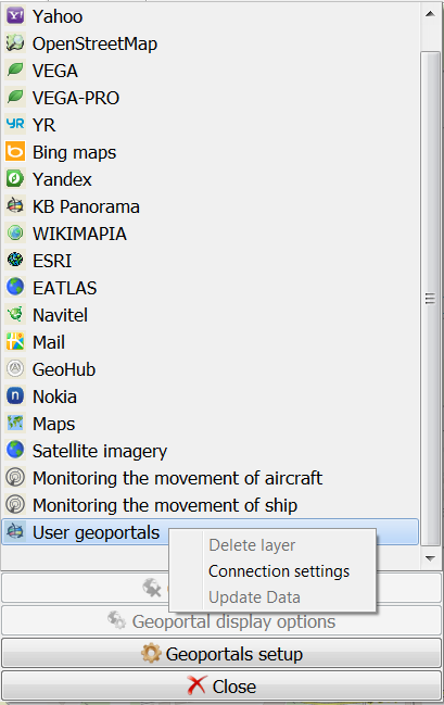
To delete a layer from the list of User Geoportals, right-click on the geoportal to be deleted and select the Delete layer menu item.
Deleting a layer
Some geoportals support a dynamically expanding list of geoportal data. When you select such a geoportal, a GetCapabilities request is submitted to the service and, based on it, the list is automatically expanded with current data in the form of a tree of available layers. Such geoportals include the KB Panorama geoportal and the RGIS of the Ryazan region. You can request the current composition of data using the menu button Update data.
|