Connection of vector data from WFS services |


|
|
Opening data in a separate window or adding it from arbitrary geoportals is possible using the menu File → Geoportals → Map from the WFS-server (to access vector and semantic data).
Loading vector data in a new window
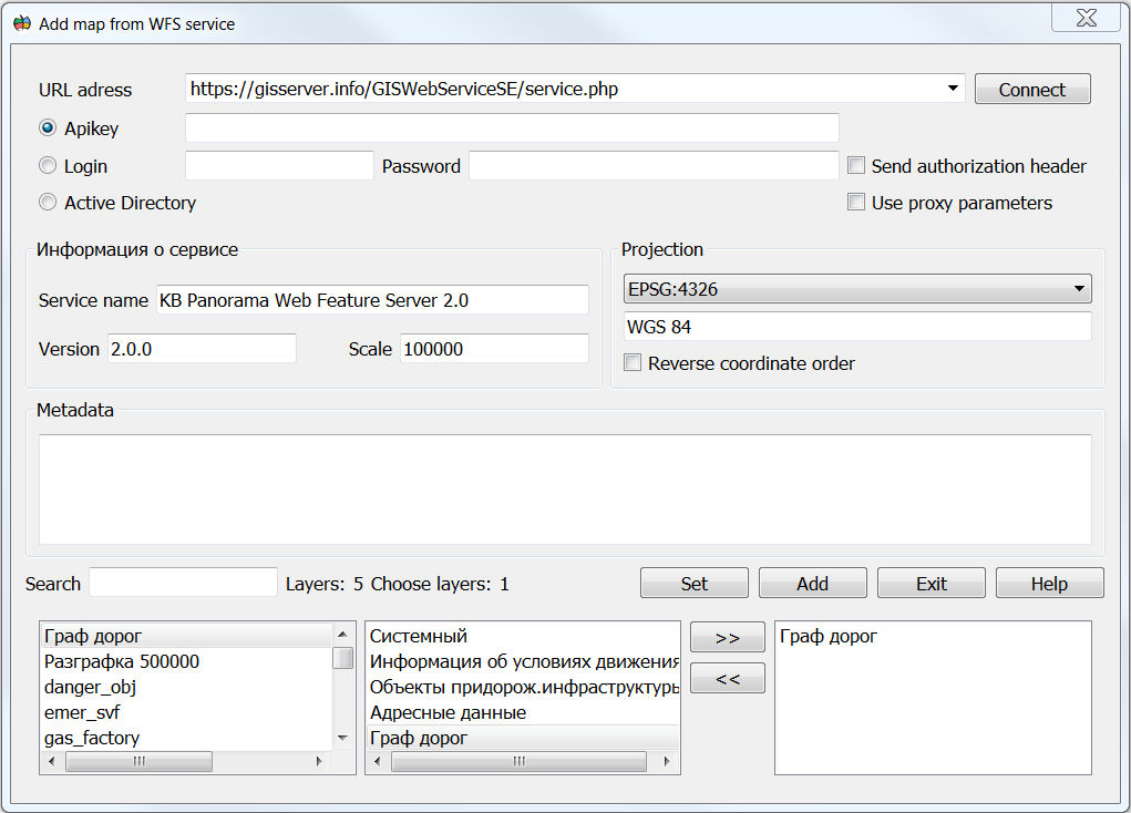
To open data from the geoportal in the dialog, you need to perform the following steps: 1. In the dialog, in the URL address field, specify the server URL (for example, https://gisserver.info/GISWebServiceSE/service.php). 2. Click on the Connect button. 3. Select the required data from the list of layers by selecting the layer and clicking on the >> button or double-clicking on the required layer in the list. 4. Click on the Add or Set button to start the process of displaying spatial information from the server.
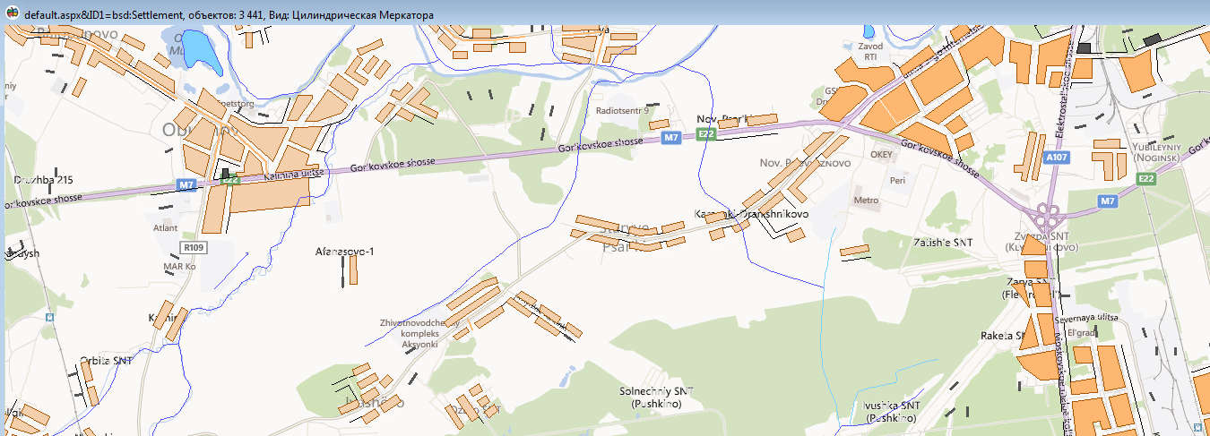
Combining a vector map from the WFS service and data from the VirtualEarth geoportal
To delete data from the list, you must click on the << button or double-click on the required layer in the list in the right field. The user can select a reference system that allows you to set the data projection and scale range for displaying the data. To do this, you need to select the reference system of interest in the Projection list. The reference system affects the speed at which data is displayed. If the selected projection coincides with the projection of the map or raster data, then the display speed is maximum. When adding data, the geoportal always converts open data to its projection. To reset the projection to the initial state it is necessary to press the Reset button in the Options → Current projection menu. Some geoportals can provide information with their own coordinate order. If the user, when connecting a geoportal, sees that the picture is displayed on the wrong area, but with inverted axis values, then for this, when connecting, it is necessary to specify the coordinate order - Reverse coordinate order.
For user convenience, a quick search (navigation) has been added through the list of layers available on the server. To do this, in the Search field, the user must enter the first letters of the name of the layer he is interested in and the list will automatically go to the layers of interest to him.
Built-in WFS service client functions are required for remote connection, display and editing of vector data. Connection to WFS-service is carried out on the basis of standards of OGC 09-025r1 Web Feature Service and ISO/DIS 19142 for GML language. Simultaneously, data from any number of WFS services can be opened together with data from geoportals, data from GIS Servers, and locally open data. To increase the speed of working with the WFS service, data caching is supported on the client.
Spatial data is transmitted in GML format, in accordance with the selected application schema. For data exchange of digital topographic maps, the application scheme described in the document «Data Specification for the Interchange of Digital Topographic Maps in GML Format» can be used. Operations of creating, deleting or changing objects are performed in transaction mode. This increases the reliability of the program, ensures the cancellation of any changes and correct editing of data when several clients have simultaneous access to the WFS service. Functions of the WFS service's client can be used for enabling GIS from different vendors to work together on any platform. Connection to WFS-service is carried out on the basis of standards of OGC 09-025r1 Web Feature Service and ISO/DIS 19142 for GML language. |