Correction of registry errors |


|
|
To form the Report, it is necessary to prepare a map with corrections of registry errors. Then select on the map all corrected objects (land plots, parts of land plots, OKSs, boundaries), information about which should be included into the report and press the Correction of registry errors mode button. The Correction of registry errors dialog will be displayed.
At the top of the dialog there are on-screen buttons and a set of tabs for selecting displayed elements.
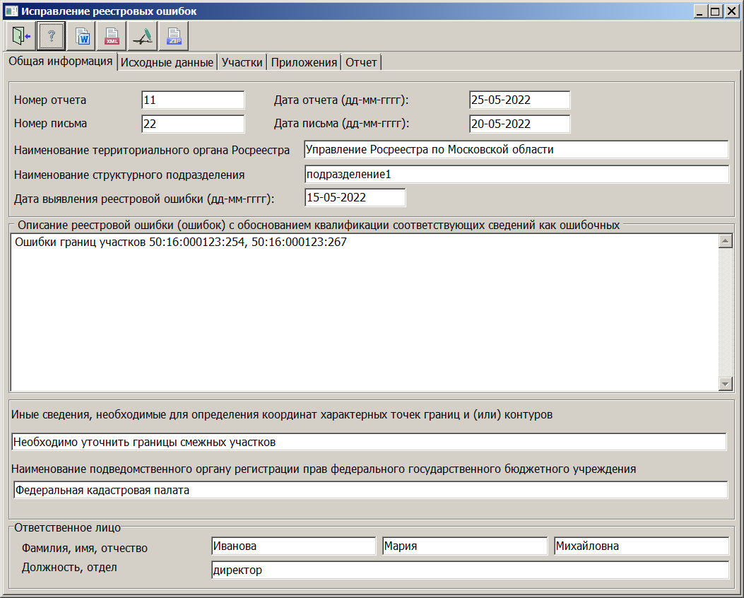
The lower part of the dialog displays elements for viewing, entering and editing information about real estate objects, including pages: — General information — Initial data — Applications
On the pages Plots, Parts of plots, Buildings, structures, Borders, zones lists are displayed containing information about the corresponding cadastral objects.
The user needs to fill in all the fields on the General information, Initial data, Applications pages and click the Formation of a text report button. The program reads the entered data, analyzes the map and forms a report. When forming a report, docx format templates containing markers are used. To fill in the markers, information specified in the dialog, data about semantics and metrics of cadastral objects, and graphic files containing an image of the boundary scheme are used. Graphics files must be in the same folder as the map and must be in PDF or JPG format.
For reuse, the values entered in the dialog are saved into the correction.ini file. If not present (the first saving), the file is created in the c:\Users\User\AppData\Roaming\Panorama\ folder (according to the path where the panorama.ini file is located). The report is formed using the automation commands of office programs Microsoft Word or OpenOficce Writer. To save the report as a PDF file, you must use office software. To create an XML file according to the ReportRegistryError_v01.xsd scheme, you need to click the «Formation of an XML document» button.
The scheme is intended for formation of an electronic document - a report about the results of determining the coordinates of characteristic points of the boundaries and area of land plots, the contours of buildings, structures, unfinished construction objects, boundaries (parts of boundaries) of municipalities, settlements, territorial zones, forestries.
The XML file is created based on the prepared cadastral map, on which existing and corrected objects from the «Correction of registry errors» layer of the survey.rsc classifier of the current version must be put. On the map it is necessary to mark the corrected objects: land plots, buildings, structures, unfinished construction objects, boundaries of a municipality, settlement, territorial zone, forestry. Parts of land plots do not need to be marked. Data about the parts is written into an XML file together with information on the land plots on which they are located. To control the electronic document, the XSD-scheme is used, which should be placed in the RegistryError_v01 folder. |