Location |


|
|
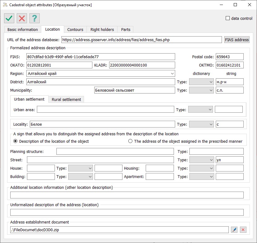
Information about the location (address) of the cadastral object is read from pre-installed semantics and displayed in the dialog box elements on the Location tab.
Attributes characterizing the location of the object are used when filling out the report and XML document. For a number of address attributes, in addition to the actual values of the address elements, it is necessary to specify the type of address element. Mandatory fields in the XML document are highlighted in yellow on the form. A list of pre-installed semantics for location (address) is provided in a table.
Input of information in the dialog elements is implemented as simple character input that characterizes the corresponding attribute value. For address attributes that have a specified value type, semantics must be entered in pairs (for example, district and type of district, name and type of city). An alternative description of the location of cadastral works is used to enter information about the name of a non-profit organization or any other informal description of the object's location.
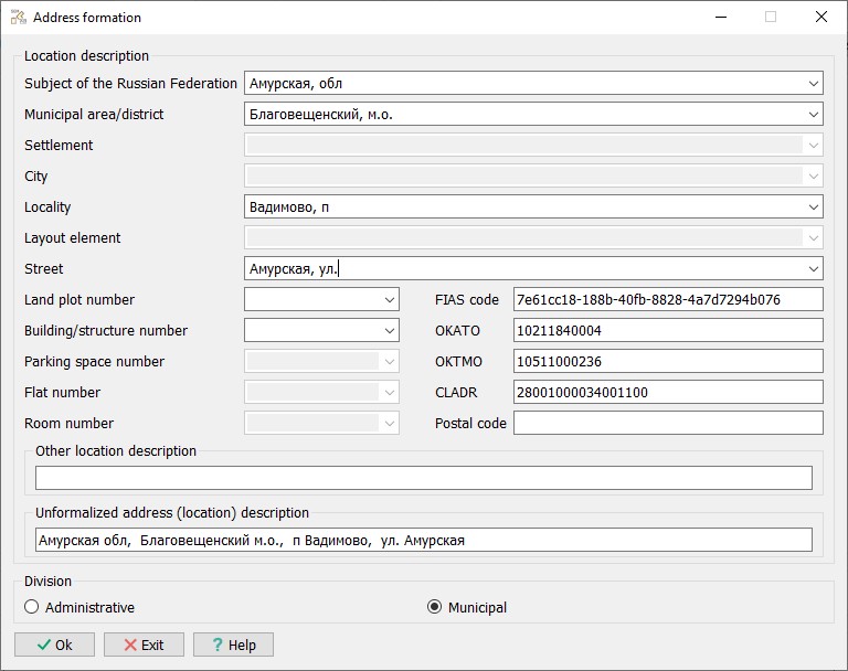
An informal description of the address (location) is used to provide information about the object's location in the form of coherent text explaining the location of the cadastral works on the ground. If this field is filled, it takes priority for inserting values into the report fields when completing the report. To utilize information from an external hierarchical database of address-territorial entities, there is a button labeled Address FIAS in the dialog. If there is access to the Internet, a window will appear on the screen that allows for entering an existing address by sequentially selecting values for address elements according to their hierarchy.
The selection of address values can be made considering two options for the hierarchy of address-territorial entities: — Administrative; — Municipal.
Filling out information about the location of the object for urban settlements (districts) and rural settlements differs slightly and is conducted either for one or the other type of territorial entity. |


