Contours |


|
|
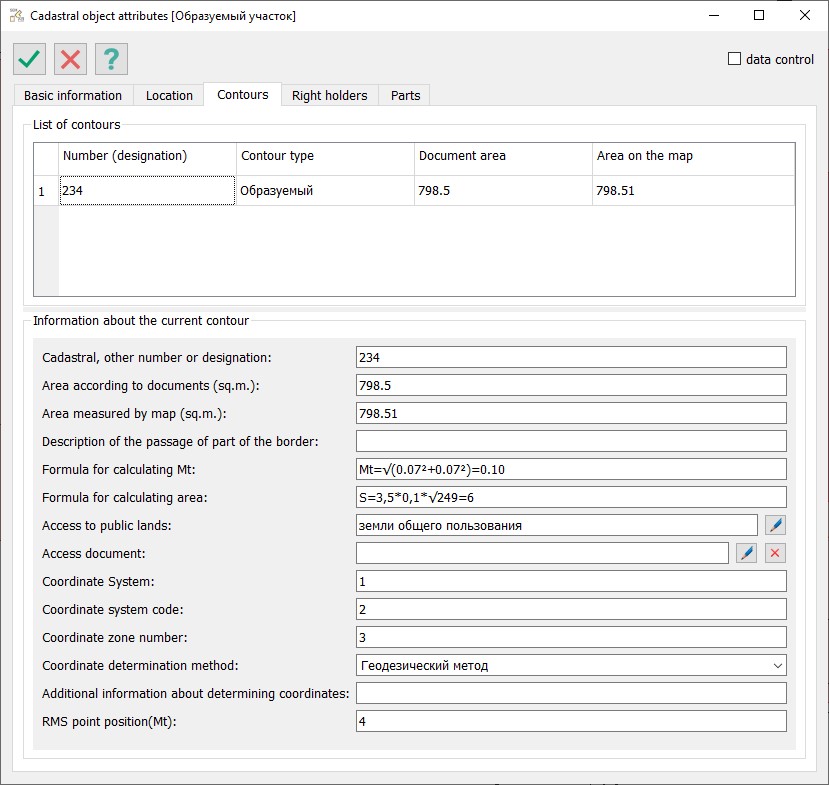
On the Contours tab, information about the external contours of the cadastral object is displayed.
If the object has a single contour, only one row will be presented in the Contour Lists element. If the object has multiple contours (a set of several objects), the number of rows will correspond to the number of external contours. The composition of the external contours is read automatically by the program.
When editing the registration data of the external contour, it is mandatory to fill in the value for the element 'Cadastral, registration, or other number or designation.' When filling in this element, the registration number of the contour is used for objects registered in the Unified State Register of Real Estate (EGRN) or the designation of the contour for newly formed cadastral objects. The designation value is determined by the requirements for forming the corresponding cadastral document (boundary plan, technical plan, land management object map (plan), territory map-plan, etc.).
For all existing contours, the attribute 'Area according to documents' must be filled in. Information about the area of contours (measured, according to documents, minimally and maximally permissible) is used to calculate the area value of the cadastral object. All entered values are saved in the semantics of the map object — the external contour of the cadastral object.
|

