Text report of the map (plan) of the object |


|
|
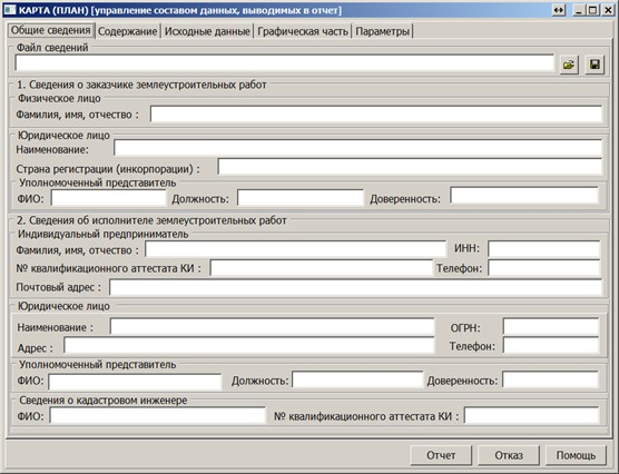
Managing the composition of map sections (plan) is done in the Map (plan) dialog box. On the General information tab, it is necessary to specify information about the client of land surveying works and information about the performer of land surveying works. This information is used when filling out the title page.
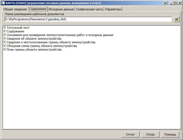
Information about the performer of land surveying works can be saved for reuse in a *.ELW information file. On the Contents tab, the composition of sections included in the report and the folder where mode templates are located are specified. Only those sections indicated on the "Contents" page will be inserted into the report.
By default, the template folder specified in the Geodesic Editor settings is used. The necessary templates for creating a map (plan) are included in the standard delivery of GIS Panorama. The list of section names and their corresponding document templates is described in the dot.ini file under the [MAPPLAN] section. One line corresponds to one section of the map (plan).
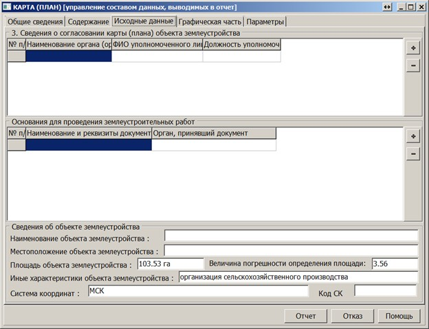
The Initial data tab displays information placed on the title page "Information on the approval of the map (plan) of the land management object", in the section Grounds for land surveying works and in the section Information about the land management object. All entered information is saved in the map object's semantics for reuse.
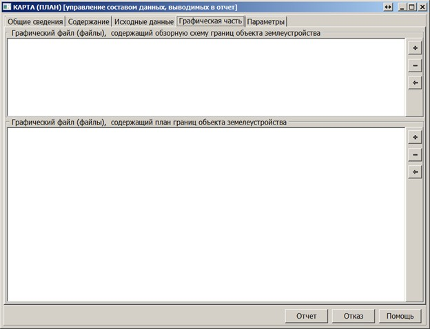
On the Graphic part tab, the composition of images used for automatically filling out the map (plan) form is specified.
In accordance with item 25 of the "Requirements for preparing a map (plan) of a land management object," it is permissible to draw up a plan of the boundaries of a land management object on a separate sheet for each part of the boundaries of a land management object. In this case, an overview scheme of the boundaries of the land management object is provided in the graphic part of the map (plan) of the land management object. Thus, the total number of sheets in the graphic part will be N + 1, where N is the number of images of parts of the boundaries of the land management object. Overview schemes and fragments of the plan of boundaries are prepared in advance.
To create images for the graphic part, it is necessary to: 1. Prepare the appearance of the map image; 2. Select the area for saving the image; 3. Choose the scale and format of the printed sheet for the image; 4. Save the image to a file.
An overview diagram is provided at a small scale that allows for a view of the entire land management object, while individual fragments of the boundary plan are presented at a scale that ensures the readability of the locations of characteristic boundary points of the land management object.
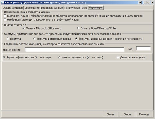
To specify multiple graphic files, use the Add Image and Delete Image buttons. The Parameters tab specifies some settings used in preparing and automatically filling out the report.
Once general information, content, and composition of graphic files are set, click the Execute button. The map (plan) form is initialized and filled with necessary information. The result is provided as a Microsoft Word file. |