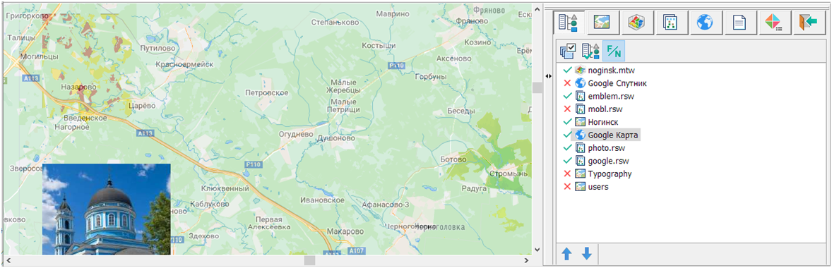
General data list |


|
|
To classify the type of data in the general list, the indication of elements in the form of pictograms is provided. Enabling and disabling the visibility of data is carried out by pressing the left mouse button (Left) in the display area of the «tick/cross» icon or the «spacebar». Data elements names can be represented as a full path or an abbreviated name. With the help of the modes «Above», «Below» the selected data element is moved by one position. To change the order of displaying several elements of the list, the mode of transferring elements with the mouse (Drag&Drop) is available. Selection of list items is carried out using the key combinations Ctrl + Left, Shift + Left. To restore the standard display order by data type, you must use the «Set default order» mode. For processing all types of data, the following modes are provided: «Display», «Above the map», «Visibility limits», «Go to ...», «Brightness/Contrast», «Add», «Add from directory», «Close».
The assignment of general data properties is available in the context menu on the «General data list» tab.
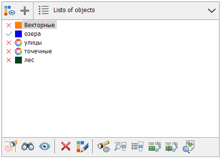
At the bottom of the «General data list» tab is the «Lists of Object».
|