Customizing additional parameters |


|
|
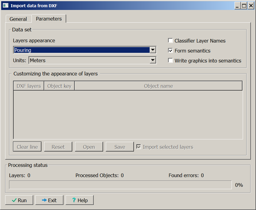
Procedure dialog box. Parameters tab
Data Loading Types
The converter performs two types of loading: 1. Loading with preservation of graphic appearance of objects 2. Loading by map object classifier
Loading with Preservation of Graphic Appearance of Objects 1. Select Fill or Contour in the Layers appearance dropdown list. 2. Ensure that map objects have: • zero classification code, • graphic description according to ACAD primitives (color and, if possible, line type).
Line Type Limitations • Preserved: solid, simple dashed, and simple dotted lines. • Replaced with dotted lines: dash-dot, complex dashed, and complex dotted lines. • Replaced with offset dotted lines: complex lines containing symbols or signs.
Hatching
The converter supports: • 90-degree grid, • vertical lines, • horizontal lines.
Other types of hatching are not performed.
During contour loading, fill and hatching are absent on the map.
Adding Semantics 1. Enable loading with semantics addition. 2. Ensure all objects contain Own Name semantics (caption text). 3. Set semantic value: • ACAD layer name or • corresponding map layer name (depends on the state of the Classifier Layer Names toggle).
Before loading: • Edit the map classifier using ACAD layer names as identifiers.
Block Processing
Objects created from block descriptions contain Own Name semantics (caption text). 1. Use ACAD block name as the value. 2. If semantics are repeatable (the Allow repetition flag is enabled in the classifier), save: • block name, • layer name, • line type, • other parameters from the DXF file.
For object recoding: • Edit objects using established semantic values.
Loading by Map Classifier with Object Recoding 1. Enable the Object Name or Object Key button. 2. Ensure the input DXF file is formatted so that: • DXF layer names correspond to map object names or keys, or • the map classifier is edited so that object names correspond to ACAD layer names.
During loading: • objects receive classification codes from the map classifier by DXF layer name, • ACAD object graphic appearance is not preserved.
Customizing of conformity of objects keys and ACAD layers 1. Go to the Parameters tab. 2. Select Layer Appearance Settings Table in the Layer Appearance dropdown list. 3. Assign conventional signs from the RSC classifier to required layers. 4. Enable the Import Selected Layers property so that only layers with assigned conventional signs are applied to the map.
Result: • Settings are saved in the <classifier_name>.cus table. • Table data is used for object recoding.
Measurement Units Setup 1. Check the coordinate measurement units type in the Units dropdown list (from DXF file or meters). 2. If you need to ignore measurement units from the source file, select Meters. |