Customizing general parameters |


|
|
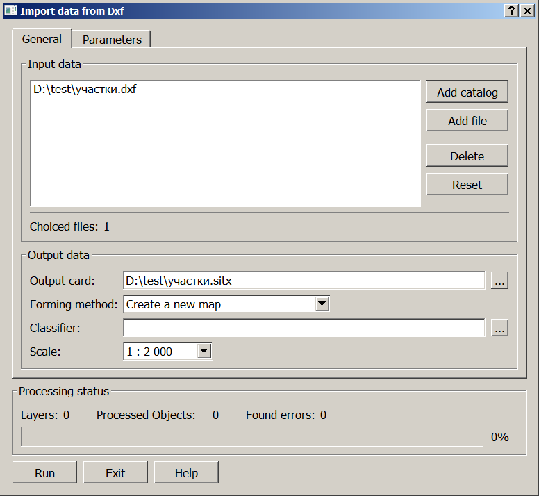
Procedure dialog box. General tab
To perform the import, it is necessary to specify the name (path) of the DXF-files by a choice of the catalog containing DXF-files, or a separate DXF-file. The name of the formed map is automatically set by the name of the input file and can be changed. The data can be loaded into a new map or added into an existing one. To add objects into an existing map, select «Add to existing map» in the «Forming method» drop-down list. Otherwise a new map is created. The type of a new map depends on the established units of measure of downloaded ACAD data. When loading data in meters, a user map is created, the metric of objects is formed in meters on the ground in a conditional coordinate system. When you select the «Create with selection» option in the drop-down list for map creation, the dialog for creating a map passport is called, which allows you to set the necessary map parameters. Group loading of DXF files is carried out, if the list of input data contains several DXF files. The files are located in the same folder. The data is imported either into a single map, or a separate user map is created for each file. To load each source file to an autonomous map, select the Create a set of cards option in the Forming method drop-down list. In this case the result of group loading is saved into MPT project.
The choice of classifier depends on the status of the output card: • for an existing card, it is automatically determined by which classifier the card was created; • for a new card, you must select the name of the classifier. The map scale is set according to the standard scale range.
Customizing additional parameters
|

