Land survey plan, version 6 |


|
|
To automate the processes of preparing cadastral documents, there are used the preset settings for the codes of objects and attributes of the digital classifier of the map the survey of versions 5 and 6 (survey.v5.rsc, survey.v6.rsc). If there is no map created according to the survey classifier in the data composition, the buttons of the «Cadastral documents» panel will not be available. Depending on the version of the survey classifier, different versions of the XML-document survey plan are formed. Files of all versions of the survey digital classifier, containing the necessary composition of objects and attributes of the cadastral map, are included in the program delivery.
The procedure «Formation of a land survey plan» provides support for the formation of reports on one of the following options: - one land survey plan for the object selected on the map; - one land survey plan for a multi-contour land plot; - one land survey plan for a group of selected one-contour land plots; - several land survey plans for a group of selected one-contour land plots; - one land survey plan for one or several formed parts of the selected land plot (one or multi-contour).
On the «General information» tab, enter the data necessary to fill in the details of the title of the electronic document.
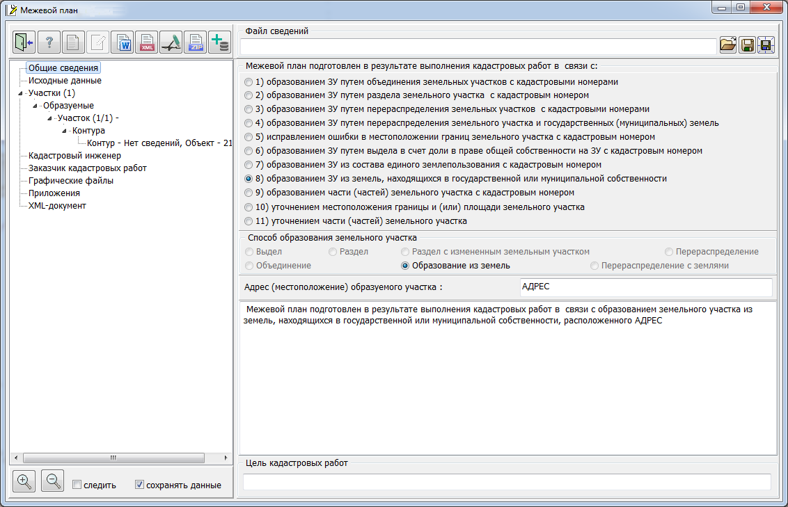
The input of information in the element «Land survey plan was prepared as a result of cadastral work in connection with:« agreed with the element «Mode of formation of a land plot». When you select the appropriate item in the element «Land survey plan plan was prepared as a result of cadastral work in connection with:» only available modes of forming a land plot are activated. Simultaneously there are displayed or hidden the elements for entering attributes in the text «Type of cadastral works»: the number of plots, address and cadastral numbers. If necessary, the automatically generated text «Type of cadastral work» can be edited. In the position «purpose of cadastral works» the relevant information is entered.
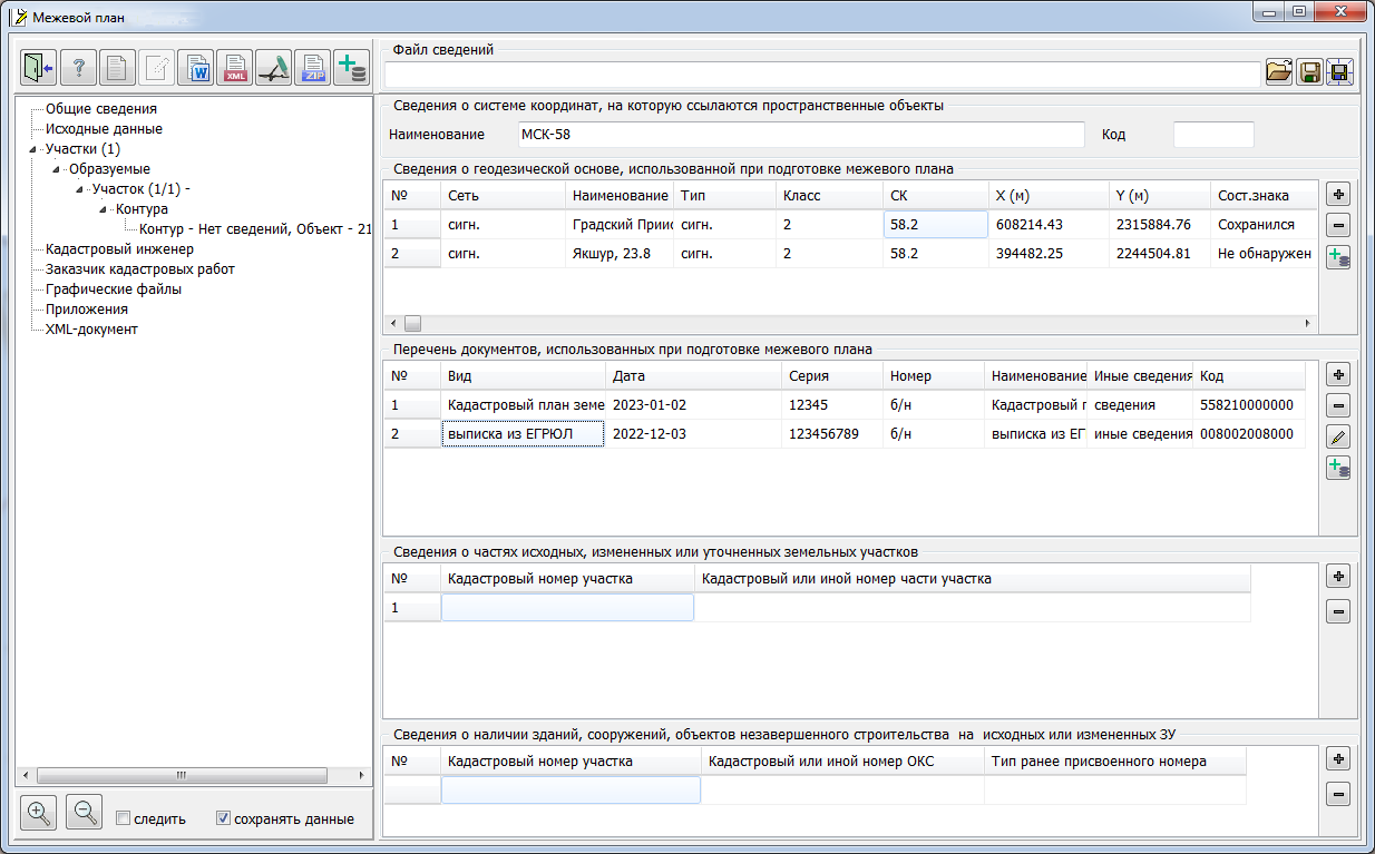
In the «Initial data» group, information about the coordinate system, geodetic base, documents used in the preparation of the land survey plan is entered. The element «Information on the presence of buildings, structures and objects of construction in progress» is filled in automatically based on the data entered on the cadastral map. The analysis process uses information about parts of the initial or modified land plots. If necessary, the list of buildings, structures and objects of construction in progress can be changed. However, this information is used only in the current session and is not saved into the cadastral map. The element «Information about parts of the initial, changed or adjusted parcels» is filled in automatically. If necessary, the list of parts can be changed. However, this information is used only in the current session and is not saved into the cadastral map. The information in the «Plots» group is filled in on the basis of the data read from the cadastral map and is included in subgroups in accordance with the type of the found plot: initial, new, changed and adjusted. The program automatically analyzes the composition of selected objects and compiles a general list of land parcels. At the same time, an analysis is made of the presence among the selected objects of sets characterizing multi-contour land plots and uniform land tenure.
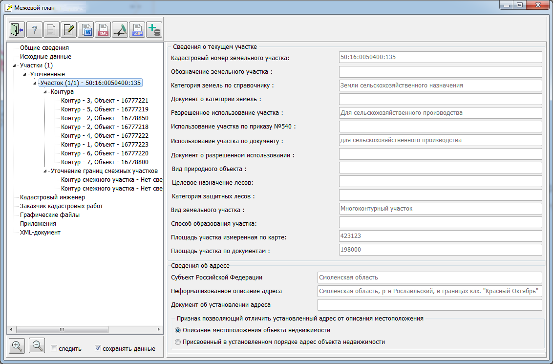
When you select the «Parcel» node in the data list, in the right part of the dialog, information about the selected parcel is displayed: cadastral number, designation on the map, land category, type of permitted use according to the directory and according to the document, mode of parcel formation, area of the parcel measured on the map and indicated in documents. To edit information about a land plot, you must call the Cadastral object attributes dialog. To call the dialog, you must select the «Parcel» node (or one of the nodes «Contour», «Contour parts» included in it) and press the button
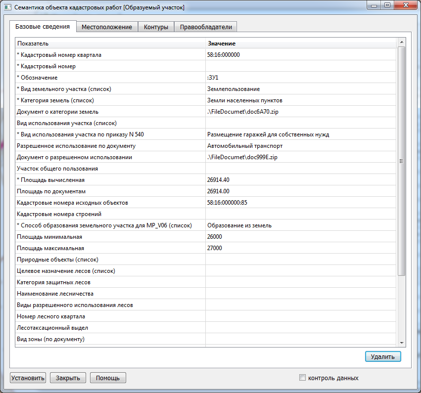
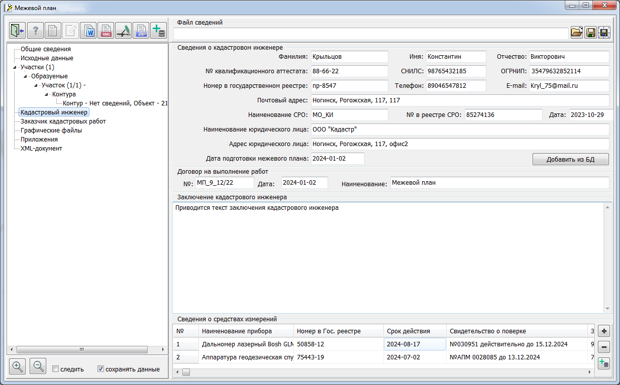
When you start the dialog Cadastral object attributes the page «Land plot» is activated. To edit information about the entire land plot (land use, multi-contour plot, uniform land tenure), you need to switch between the pages of the dialog the «Basic information», «Location» and «Additional Information». To edit information about the contours of a multi-contour land plot or about isolated or conditional plots that are part of a uniform land tenure, the page «External contours» is intended. To edit information about parts of a land plot, use the «Internal parts of a plot» page. When editing information about contours (isolated or conditional sections), it is necessary to fill in the semantics the registration number. To view and edit information about the cadastral engineer, select the «Cadastral engineer» node. The right side of the dialog automatically displays the relevant information.
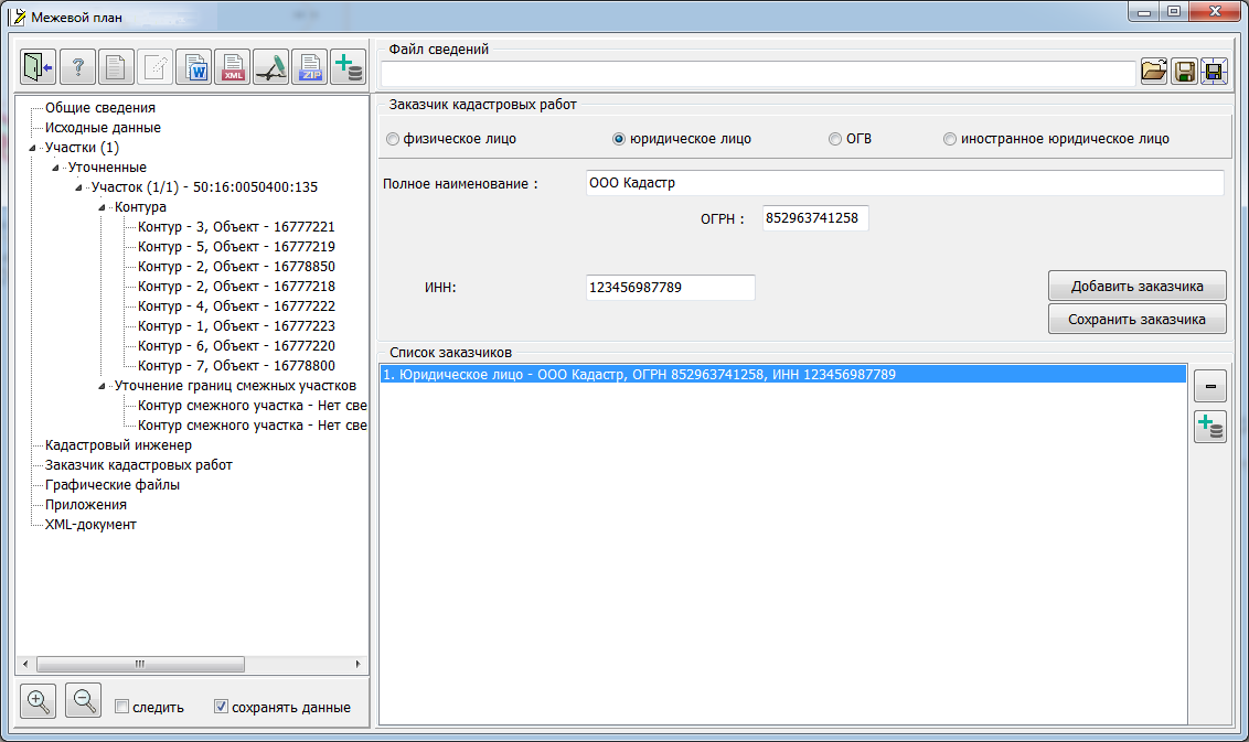
All positions in the element «Information about the cadastral engineer» must be filled. The element «Information about measuring instruments» is intended for entering data on devices and tools with which cadastral work was performed. Information about the customer of cadastral work is required to fill in the sections of the electronic XML document. To enter and edit them, you must select the «Customer cadastral works» node. In the right part of the «Land Survey Plan» dialog, the relevant information will automatically be displayed.
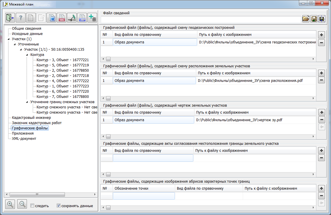
Since there may be several customers, the formation of a list of customers for each object of cadastral work is provided. The «List of customers» element displays information about the entered data for customers. To add a new customer, you must fill in all the positions in the «Cadastral work customer» element and click the «Add customer» button. To edit information about a previously entered customer, you must select the desired customer from the list. At the same time, the information in the «Cadastral works customer» element is automatically updated. After entering and editing the data, you must click the «Save customer» button. If you need to save the edited data as new, click the «Add customer» button. To delete a customer from the list, use the When you select the «Graphic files» node in the right part of the «Land Survey plan» dialog, elements for entering and editing information attached to an electronic XML document in the form of scanned images are displayed. The dialog contains elements for editing the following lists of graphic files: - information about the performed measurements and calculations; - scheme of geodetic constructions; - scheme of location of the land plot; - drawing of land plots; - approval acts of the location of the border of the land plot; - outlines of the characteristic points of the boundaries.
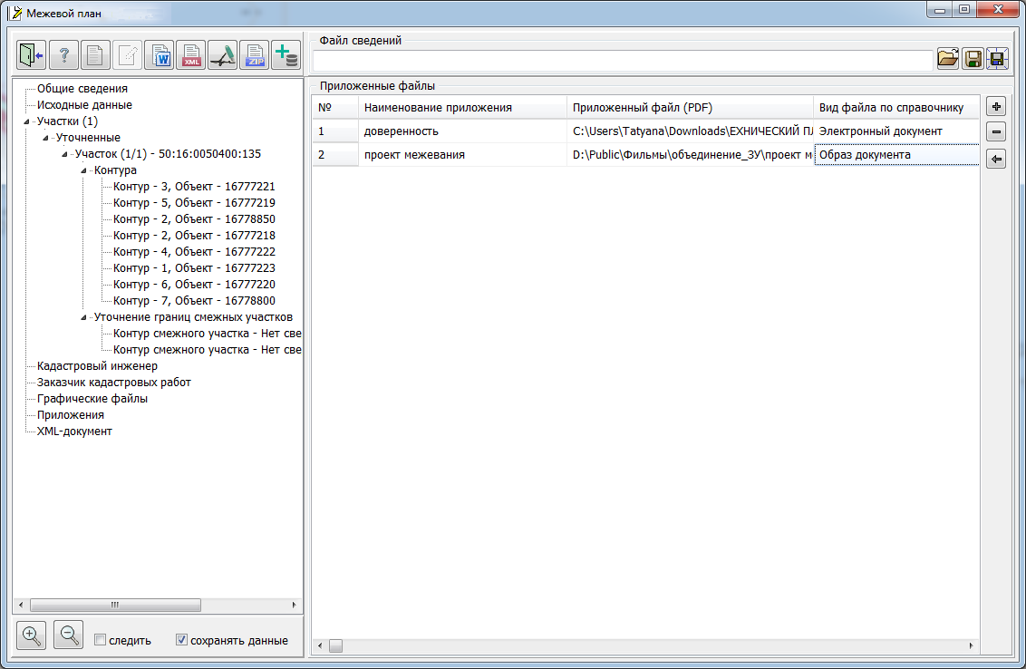
The information specified in the elements of the «Land Survey plan» dialog for the «Graphic files» node is used when filling the sections of the electronic XML document and is included into the ZIP package for sending to the State Property Committee. You can use JPG, TIFF, or PDF files as data about the graphic part. Obligatory for filling is the element «Graphic file(s) containing a drawing of a land plot». When you select the «Applications» node in the right part of the «Land Survey plan» dialog, elements for entering and editing information attached to an electronic XML document in the form of documents with attached image files are displayed.
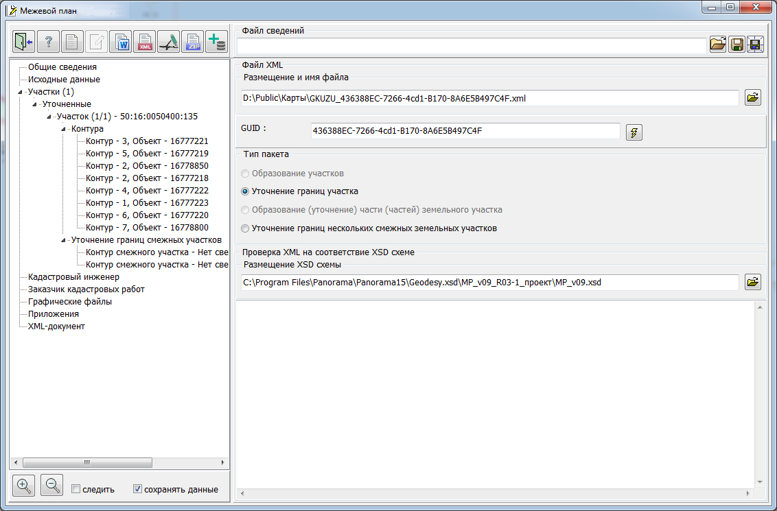
The dialog provides tools for maintaining a list of applications. The list of attached documents is editable. It is possible to add a document ( When you select the node «XML-document» in the right part of the «Land Survey plan» dialog, elements for entering and editing information about the structure of information placed in the electronic XML-document are displayed For almost all variants of formation of an electronic XML document, the positions «Type of information» and «Type of package» are filled in automatically based on the data from the title page. Therefore, radio buttons in elements may not be active. Managing the activity of these elements is associated with the choice on the title page («General Data» node) of the option for performing cadastral work. The «Archiver location for creating a ZIP package» element specifies the full path to the program that provides data compression into a ZIP file. The «XSD Schema location» element specifies the full path to the XML schema. Based on which an electronic XML document is generated.
|
 A land survey plan can be formed for one or more land plots, depending on the choice of objects on the cadastral map.