Loading geodetic network points from file |


|
|
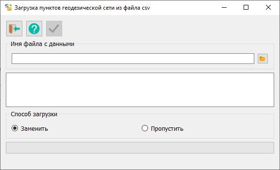
The form for loading geodetic network points from a .csv file looks as follows:
The .csv file line containing information about the loaded point should have the following fields separated by a semicolon (";"): — geodetic network point type — point name — geodetic network type — geodetic network class — coordinate system — X coordinate — Y coordinate — height — information about the condition of the point's external mark — information about the condition of the point's center — information about the condition of the point's center mark — date of inspection
If during the loading process a line with a different format is encountered, a prompt to interrupt the loading process will appear the first time. If the process is not interrupted, all subsequent "bad" lines will be ignored. At the end of the operation, a message showing the number of processed lines and their total number is displayed at the bottom of the form.
At the top of the form, there is a panel with buttons:
Below the button panel is the data file selection window. To select a file, click the button
Further down on the form are elements for configuring the loading mode for points that already exist in the database. Before saving a point to the Database, the point name and coordinate system are analyzed. If such a point already exists, selecting the "replace" mode will update its information. When selecting the skip loading method, no action will be taken. |