Setting up codes for created objects |


|
|
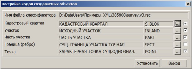
For the operation of the XML File Data Import and Save Land Plot Objects to real estate cadastre file modes, the classifier map500.rsc is configured. The codes of the created (processed) objects are set by default.
In the dialog window Setting codes for created objects, functionality is provided for selecting the symbol of the created object. It is important to remember that for symbols of created (processed) objects such as Cadastral block, Land plot, Part of the plot, Boundary (edge), Point, corresponding semantics must be set in the classifier.
Unchecking the box cancels the creation of the corresponding object on the map. |