XML File Data Import |


|
|
The mode is designed for loading data from the real estate cadastre.
During the execution of the mode, the following objects can be created on the map: — cadastral quarter (area object), cadastral quarter contour from edges (linear objects); — land plot (area object), plot contour from edges (linear objects); — parts of the plot (area objects), parts of the plot contour from edges (linear objects); — turning points (point objects).
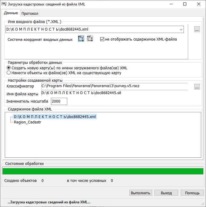
The Input File Name (*.XML) block is intended for selecting and displaying the loaded XML real estate cadastre file. After selecting the file name, the file is read and its structure is analyzed, filling in the statistics fields. The program processes XML real estate cadastre files with structure version 1.0, encoded in UTF-8, with schema version 26.
The Map Settings block is intended for: — Selecting the classifier file name with which the map will be created. For the operation of this mode, the classifier syrvey_current_version.rscz is configured. When using another classifier, it is necessary to configure it beforehand — for objects Cadastral block, Land plot, Part of the plot, Boundary (edge), Point to set corresponding semantics. — Specifying the name of the created map file. — Managing the composition of objects on the created map through the Setting codes for created objects dialog.
The creation of real estate cadastre objects on the map begins after pressing the Execute button. The total number of objects created on the map is displayed in the Objects Created field. |