Document on the establishment of the boundaries of objects |


|
|
Recommended sequence of action: - Fill in the positions of the screen form on the pages «Documents», «Applicant» and «Borders»; - Form an XML-document; - Form an electronic digital signature (All files must be located in the same folder with the XML document on the establishment of the Borders); - Form a package of information to be sent to the state real estate cadastre.
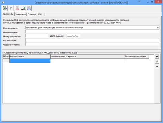
On the «Documents» page, you need to specify the details of the XML document that reproduces the information necessary for entering into the state real estate cadastre, which is transmitted to the cadastral registration authority and form the lists of attached documents. To write down the lists of attached documents, you need to click the button
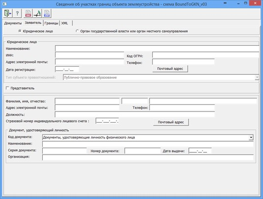
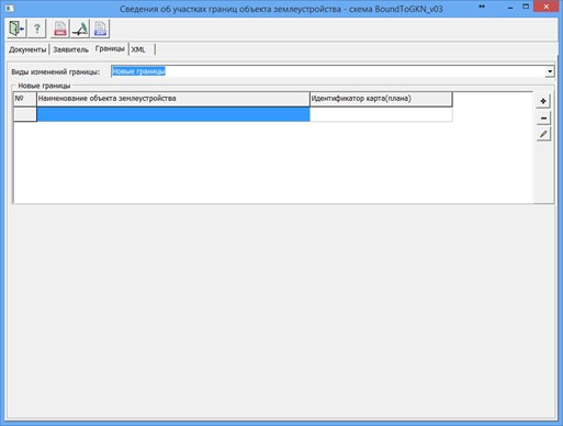
In the «Applicant» section, you must specify the applicant and fill in the active fields for this applicant. If information about the land management object (territorial zone or border of the territory) is provided on behalf of the applicant by his authorized representative, the «Representative» flag must be set in the dialog. In the «Representative» group, the required details for filling out are: last name, first name, position, as well as information about an identity document. On the «Borders» page, the type of borders changes is selected and a list of borders is formed by the button
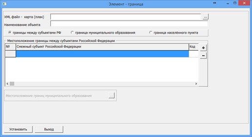
In the «Border» section, the required element to fill is the «Object name». For the border between the subjects of the Russian Federation, it is necessary to create a list of adjacent subjects of the Russian Federation in the table «Location of the border between the subjects of the Russian Federation», for the border of a municipality or the boundary of a settlement, fill in the «Location of the borders of the municipality» dialog, which is called by pressing
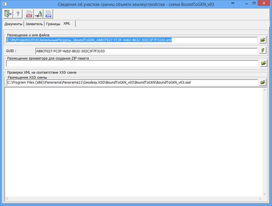
In the «Element - border» dialog, it is necessary to add information about the XML file formed earlier in the «Formation of a map - (plan) of a land management object» task. When you click on the «Map plan» button, a dialog is called for filling in data about the document - a map (plan). When you exit the dialog, the entered data is automatically saved to an XML file, the name of which is specified on the «XML» page into the «XML_BOUND» semantics of the map object. When the mode is opened again, the information from the XML file will be automatically read and displayed into the corresponding dialog elements.
To automate the processing of cadastral and land management data, the preset settings for the codes of objects and attributes of the digital classifier of the survey map of the actual version are used. Digital classifier survey of the actual version, containing the necessary composition of objects and attributes of the cadastral map, is included in the delivery of the program. |