Document on the establishment of territorial zones |


|
|
Recommended sequence of action: - Fill in the positions of the screen form on the pages «Documents», «Applicant» and «Zones»; - Form an XML-document; - Form an electronic digital signature (All files must be located in the same folder with the XML document on the establishment of the Zones); - Form a package of information to be sent to the state real estate cadastre.
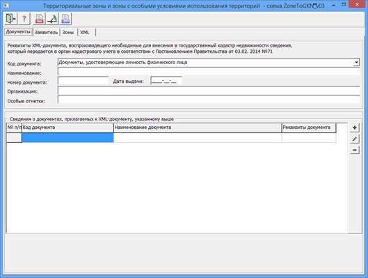
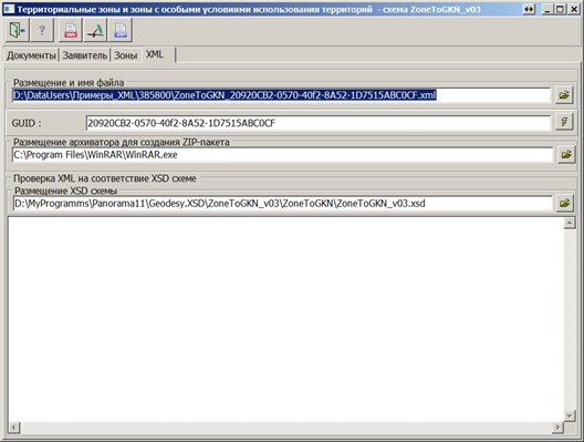
On the «Documents» page, you need to specify the details of the XML document that reproduces the information necessary for entering into the state real estate cadastre, which is transmitted to the cadastral registration authority and form the lists of attached documents. To write down the lists of attached documents, you need to click the button
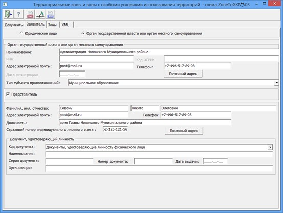
In the Applicant section, you must specify the applicant and fill in the active fields for this applicant. If information about the land management object (territorial zone or border of the territory) is provided on behalf of the applicant by his authorized representative, the «Representative» flag must be set in the dialog. In the «Representative» group, the required details for filling out are: last name, first name, position, as well as information about an identity document. When filling in information about the address, the obligatory requisite is the «Region code». Attributes characterizing the address of a land management object are used in complex when filling an XML document. For address attributes that have a value type, semantics must be entered in pairs (for example: name and type of the city, street and type of the street). To write an address attribute into an XML file, you need to enter the value of the address element (district, town, street, house, building, stroenie, apartment) and specify the type. Types without values are not written into files.
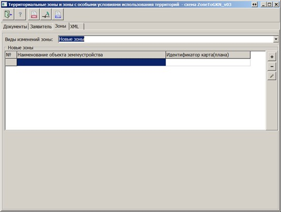
On the «Zones» page, the type of zones changes is selected and a list of zones is formed.
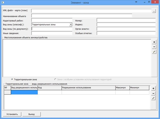
In the «Element - zone» dialog, the required details for filling are: «Name of the object», «Cadastral district», «Type of zone by classifier», «Number», as well as the section «Locations of the land management object».
Into the section «Locations of the object of land management» the addresses of the object are recorded. You can call the dialog for forming a list of addresses by clicking the button/ For the «Territorial zone» the mandatory element to fill in is «Types of permitted use», and in this element the required attribute to fill is the «Permitted use». For the «Zone with special conditions for the use of territories», the mandatory element to fill is the «Content of restrictions». When you exit the dialog, the entered data is automatically saved to an XML file, the name of which is specified on the «XML» page into the «XML_ZONE» semantics of the map object. When reopening, the data is restored automatically.
To automate the processing of cadastral and land management data, the preset settings for the codes of objects and attributes of the digital classifier of the survey map of the actual version are used. Digital classifier survey of the actual version, containing the necessary composition of objects and attributes of the cadastral map, is included in the delivery of the program.
|
 The mode is designed to form a document that reproduces information about the establishment, modification, termination of existence of zones with special conditions for the use of territories, territorial zones (scheme ZoneToGKN_v03.xsd).