The project land surveying |


|
|
The requirements for the land surveying project were approved by Order of the Ministry of Economic Development of Russia dated 03.08.2011 N 388. The land surveying project determines the size and location of the boundaries of the parcel or parcels that can be allocated on account of the land share or land shares (hereinafter referred to as the formed parcels).
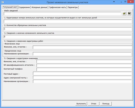
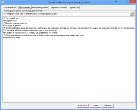
On the «Title page» page, information about the customer of cadastral works, information about the cadastral engineer is filled in. For the convenience of re-entering data, all entered information is saved in a information file (*.MPP). On the «Contents» page, the necessary sections are selected to form the document.
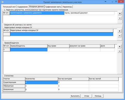
The «Input data» page displays the information that is placed in the «Input data» section of the land survey project. The information presented in the «List of documents used in the preparation of the land survey project» group can be obtained by extracting information about each land plot. In the absence of information in the semantics, the list of documents can be filled in by hand. The entered data is saved to the information file. The section «Information about land plots and their parts» is generated automatically by the program. The section contains two interrelated tables «Cadastral numbers of initial lands» and «The right holders». To fill in the table «Cadastral numbers of initial lands», the program uses information from the semantics of CADASTRAL NUMBER (therefore, it is important not to remove this semantics from the formed lands). The list is formed on the basis of information from all land plots, and only non-recurring cadastral numbers are selected. To fill in the «The right holders» table, the program uses the semantics corresponding to the positions of the table. The list is formed on the basis of the information of all land plots, while all owners are selected for each contour of the land plot. The list is sorted by cadastral number. The current state of the table «The right holders» corresponds to the current cadastral number in the table «Cadastral numbers of initial lands». When changing the position in the table «Cadastral numbers of initial lands», the contents of the table «The right holders» are automatically updated. Changes can be made to both tables if necessary. All made changes will be used when generating the report, but cannot be saved into the semantics of objects - contours of land plots.
On the «Graphic part» page, the composition of the images used in the automatic filling of the «Project plan» section is indicated. To customize the composition of graphic files, use the buttons
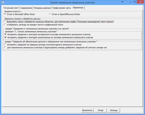
On the «Parameters» page, a number of attributes are specified that control the automated process of filling the report.
To automate the processing of cadastral and land management data, the preset settings for the codes of objects and attributes of the digital classifier of the survey map of the actual version are used. Digital classifier survey of the actual version, containing the necessary composition of objects and attributes of the cadastral map, is included in the delivery of the program. |