Certificate of inspection of the property |


|
|
The XML document is formed in accordance with the XML schema InspectionAct_v01.xsd, placed in the Geodesy.XSD directory. The presence of these data for the operation of the program is mandatory, since the specified folders contain the necessary classifiers and directories.
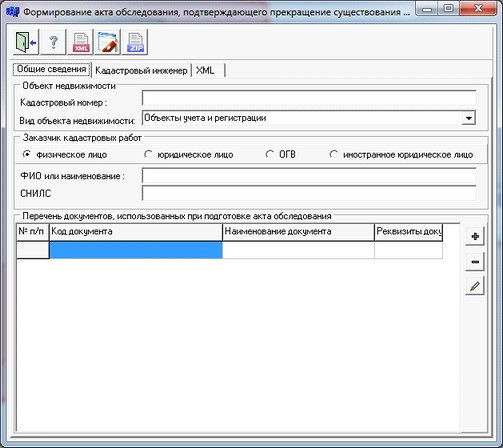
Recommended course of action: — Copy into one folder the documents used in the preparation of the certificate of inspection (PDF format). — To draw a contour of object of the real estate terminating the existence. Positioning accuracy is not important, drawing can be done schematically. — Call the mode and specify the schematically drawn real estate object. — Enter the necessary information in the dialog and form an XML document ( button — To form the electronic digital signature (button To form a package of information to be sent to the state real estate cadastre (button
Certificate of inspection consists of a set of files packed into one ZIP archive (hereinafter referred to as the package). One Certificate of inspection corresponds to one package.
The package name should look like this: act_*.zip, where: act - prefix indicating that the information belongs to the file with the information of the Certificate of inspection; * - a unique character set corresponding to the GUID specified in the data file (InspectionAct/@GUID).
The contents of the package are one XML file containing the semantic information of the Certificate of inspection, and may also contain one or more files with a PDF extension containing electronic images of paper documents used in preparing the Certificate of inspection. Each file in the package must be signed with a separate electronic signature. The electronic signature file must be located in the same directory the same as the file being signed. The electronic signature file name should look like: <name of file to be signed>.sig The XML file must be located at the root of the package. PDF files can be located in subdirectories \<directory>\<directory>\<file> (in this case, the path to the files must be specified in xml relative to the package root). Directory names and file names must not contain service characters such as: +/ \ * < >@ « » “ ” `] [ { } $ # ~.
The name of the XML file containing the semantic information of the Certificate of inspection should have the following form: act_*.xml, where: act - prefix indicating that the information belongs to the file with the information of the Certificate of inspection; * - a unique character set corresponding to the GUID specified in the data file (InspectionAct/@GUID).
To automate the processing of cadastral and land management data, the preset settings for the codes of objects and attributes of the digital classifier of the survey map of the actual version are used. Digital classifier survey of the actual version, containing the necessary composition of objects and attributes of the cadastral map, is included in the delivery of the program.
|