Create map |


|
|
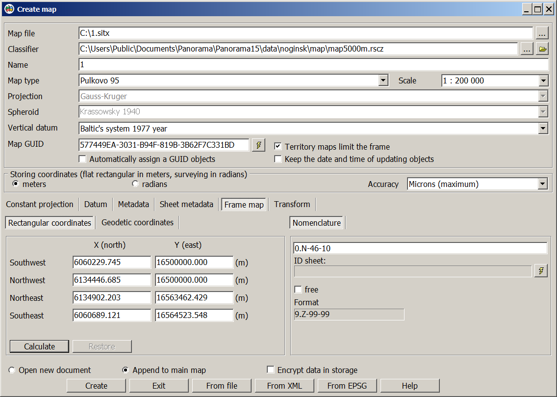
For creation of a map it is required to enter a map name, a region name, the name of classifier (RSC or RSCZ), to set type of a map, projection, spheroid, system of heights and scale, to specify kind of storing coordinates. At storage of coordinates in meters it is required to set accuracy of coordinates. If, when creating a map (plan), you specify a classifier (RSC or RSCZ) from the shared classifiers folder, it will not be copied to the folder with the map. Customizing the location of the Shared classifiers folder is done in the Placement of data dialog.
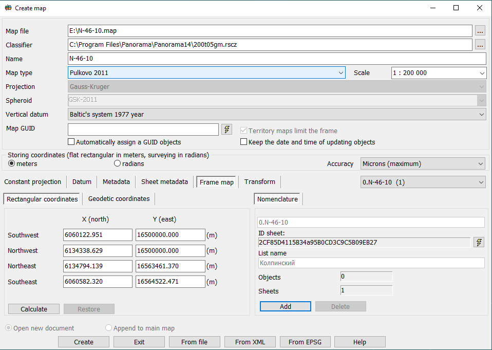
If necessary you can fill the fields in bookmarks: Projection parameters, Datum and Metadata. For creation of a map with a frame it is necessary to include an element of dialogue «Territory maps limit the frame», thus there will appear a bookmark Frame map. At presence of a frame the fields of coordinates (rectangular or geodetic) are a subject to obligatory filling. For topographical maps with the standard nomenclature these data are filled after you enter the nomenclature. To enter nomenclature when creating a multisheet map with the .map extension, you must click the Add button.
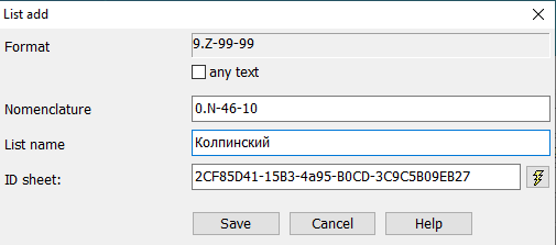
The «List add» dialog will be activated, in which the nomenclature and sheet name must be filled in. This dialog is called for each map sheet to be created.
For editing coordinates of a frame you can use the buttons Calculate, Restore. In order to set the rectangular coordinates to calculate the geodetic, please click the Calculate button on a bookmark Geodetic and on the contrary. Clicking Restore button causes a cancelling of changing coordinates. By means of the By Map button it is possible to choose an existing map, to copy from it data about projection and further to make necessary changes. By clicking the button From XML the task Parameters of reference systems from XML file is called which reads values of constant projections and Datums from .xml file. In the further the passport of a vector map can be edited. From EPSG button is intended to call the task Parameters of reference systems from base ESPG. At creation of a vector map-storehouse with extension «.sitx» there is a possibility to encrypt a map. For this purpose it is necessary to enable the option «Encrypt data in storage».
|