Topological data control |


|
|
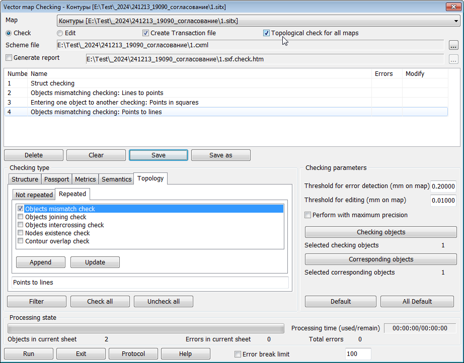
Topological data control is designed to verify the correctness of metrics and inclusion of object contours, consistency of metrics between adjacent and intersecting objects, and correspondence between relief objects and elevation matrices. Types of Topology group controls are divided into two subgroups: Non-repeatable — types of control that need to be performed only once for each map sheet; Repeatable — types of control that must be performed multiple times for each map sheet with the division of controlled objects into separate independent groups.
If the map contains several overlapping sheets with a unified classifier, a checkbox Topological control for all maps becomes available in the dialog. When this option is enabled, metric consistency verification is performed between map objects that are divided by layers across different sheets. For example, when checking the consistency of contours between areal vegetation objects located on one sheet and road network objects located on another sheet. |