Build of intersection layers |


|
|
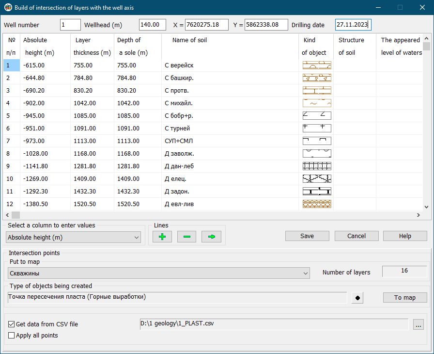
To call the dialog «Build of intersection layers», you must press the mode button and select a point object on the map - the wellhead. Next, in the dialog, select a map for drawing the results and the type of objects to be created. Based on the data on the depth of a sole of the geological layer, the spatial coordinates of the point of intersection with the well axis are calculated. The result of processing are point objects according to the number of exposed geological formations. Data about the depths of geological layers can be located in a CSV file containing point measurements: well number, name of layer, depth of a top of a layer, depth of a sole of a layer. In this case, the input data of the mode will be: a point object «Wellhead», a linear object with a 3D metric «Wellbore», a CSV file containing depth marks of the top and bottom of the layers. To select a CSV file, you must enable the «Get data from CSV file» mode. When you set the «Apply all points» mode, point objects are formed from all measurements contained in the CSV file. When this mode is disabled, only intersection points corresponding to the bottoms of the layers are formed.
|
 The mode is intended for mapping point objects describing the spatial position of the points of intersection of the wellbore axis and a sole of geological layers. As the initial data, there is used an information about opened geological layers, prepared by means of the mode