Loading vector map from DGN format |


|
|
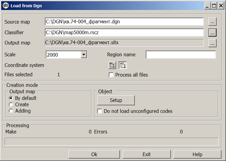
The procedure is designed for importing vector data from the DGN (Design) exchange format of the MicroStation system.
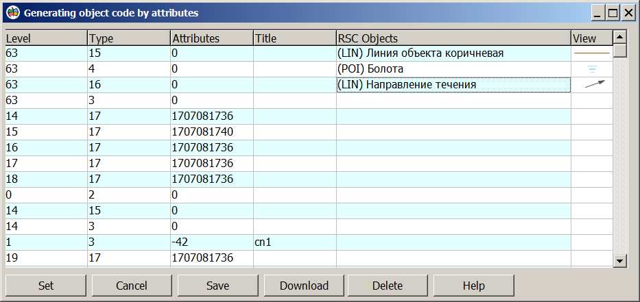
Procedure for loading information from the DGN format: 1. Primary selection of DGN format files. 2. Selection of the resource classifier file name — a file name with the extension RSC or RSCZ. 3. Selection of the output vector map name. 4. Selection of the mode for creating the output map — either creating a new vector map in GIS Panorama format or adding data to an existing vector map. In Default mode, the output map has a Latitude/Longitude type on the WGS_84 ellipsoid. 5. Selection of the scale for the created vector map. 6. Input of the name for the area of the created vector map. 7. Clarification of the orientation of the X, Y coordinates. 8. By clicking the Set button, an object view from the classifier is assigned by double-clicking for each combination of element level, type, and attribute.
The configuration parameters are saved to a settings file with a TXT extension when the Save button is pressed. When reprocessing DGN files of this type, the configured file is used when the "Download" button is pressed. Unconfigured elements are loaded onto the map with system codes. 9. Execution of the procedure.
The settings file can be created using any available text editor.
The structure of the settings file is as follows:
.DGN - start of the settings file, mandatory field. <level>, <type>, <attribute>, <key> - level, element type, attribute, object key from the classifier <level>, <type>, <attribute>, <key> ... .END - end of the settings file, mandatory field.
Example of a settings file:
.DGN 63, 15, 0, 386-000-L 63, 4, 0, 374-200-L 63, 16, 0, 210-400-L 63, 3, 0, 366-000-L 14, 17, 1707081736, 094-000-P 15, 17, 1707081740, 389-000-P 17, 17, 1707081736, .END |


