Evaluation of relief |


|
|
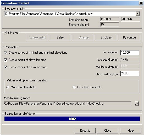
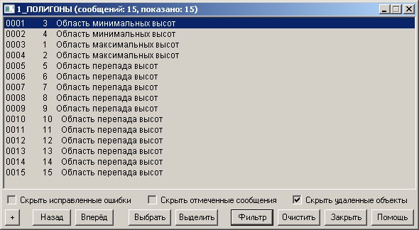
Task defines and puts on a vector map of area of the minimum and maximum elevations of a relief and area of critical drop of elevations. Drawing areas on a map is fixed in the log file accessible to viewing by means of the task «View error» in the GIS "Panorama" or "Panorama-editor". In the course of a relief's evaluation the matrix of values of drops of elevation (MTQ) is formed, used for definition of areas of critical drops.
Input data of the task: - matrix of elevations that is specified in group "Elevation matrix"; - area of evaluation that is specified in group "Matrix area"; - parameters of evaluation that are specified in group "Parameters".
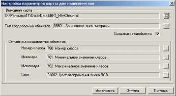
Installation of parameters of a map for drawing zones is carried out by pressing the button «>>». If parameters of a map for drawing zones have not been set, then by pressing the button "Execute" the dialog of settings is called automatically.
Output data of the task: - a vector map of zones of the minimum and maximum values and zones of critical drop of elevation (the file name is specified in group «Map for writing zones», the map classifier - service.rsc); - protocol of messages for a vector map of zones of the minimum and maximum values and zones of drops, accessible to viewing by means of the task «View error» in the GIS «Panorama 11» or "Panorama-editor"; - matrix of qualities of format MTQ, containing values of drops (filename of a matrix of qualities is formed with use of a filename of input matrix of elevation: <name MTW> _Drops.mtq) - average difference of elevation displayed in the window «Average drop»; - maximum difference of elevation displayed in window «Maximum drop»; - protocol of performing the task in the file <name of zones map>.LOG
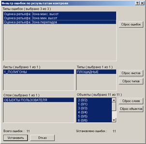
At viewing the protocol of messages by means of the task «View error» of Map Editor there is a possibility of choosing the type of viewed messages by means of button "Filter". The task of relief's evaluation forms messages of three types: Zone max. heights, Zone of min. heights, Zone of drops.
If the mode «Create zones of minimum and maximum elevations» is set, then creation of polygonal objects-ranges corresponding to areas of minimum and maximum elevations is carried out. The elements which elevation is included into a range from Min_MTW up to Min_MTW + dH are considered as areas of the minimum elevations, the elements which elevation is included into a range from Max_MTW up to Max_MTW - dH, where Min_MTW, Max_MTW - a minimum and a maximum of elevations matrix, dH - value of a field «In range» are considered as areas of the maximum elevations. If the chosen area does not contain elevations in the specified ranges, then zones of minimum and maximum elevations are not put on the output map. The list of the constructed zones is logged and is available for viewing of messages by means of the task «View error» of Map Editor.
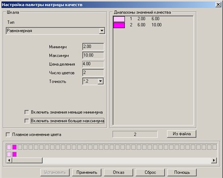
The matrix of values of drop is filled within the area specified in group "Matrix area". Value of drop for an element of MTQ matrix is equal to max (abs (H - Hi)), where H - the elevation, requested in the center of an element, Hi - elevations of eight nearest surrounding elements. In the process of filling a matrix of values of drop the maximum drop for all matrix is defined, the value of which is displayed in the window «Maximum drop». The range of values of created matrix of drops (parameters «Minimum», «Maximum» of dialogue «Data list of a map» «Matrix» bookmark) is set by values actually placed in a matrix. If the threshold drop specified in dialog is not within a range of values actually placed into a matrix the new value of threshold drop is calculated equal to the middle of an actual range. (MaxFact - MinFact) / 2, where MaxFact, MinFact - a range of values, actually placed in a matrix. New value of threshold drop is displayed in the window «Threshold drop» and can be changed by user. Construction of zones by values of elevation's drop is carried out with use of a matrix of drop's values (MTQ). During construction of zones the polygon objects of a vector map are created, limiting elements which values are included into the specified range of values of a matrix. If the matrix of values of drop (MTQ) with a name <name MTW>_Drops.mtq exists and is added into document the construction of zones by values of elevation's drop can be carried out without constructing a matrix with the disabled mode «Create matrix of values of elevation drop». The formed matrix of drops is added into the document with parameter «Visibility - Middle». Matrix visibility can be changed by button «Properties» of the «Matrix» bookmark of dialog «Data list of a map». The palette of a matrix of drops, number of colors and a range of displayed values (minimum, maximum) can be changed in the task «Map Legend» the «Matrix» bookmark on the menu item "the Palette" called by pressing of the right button.
|