Information about map object |


|
|
The mode of request for information about the map object is activated. After activation of a mode the pressing the left mouse button over the map object will result in the occurrence of a dialog window of brief information about the specified map object. Due to the fact that the digital map has multilayered structure, in the point specified by a crosshair, can be simultaneously located several objects. Therefore after the first click the dialog box displays information about topmost object. There is a possibility of vertical level-by-level move by pressing the buttons Next and Prev. Dialog allows to view and to edit semantics, metrics, appearance (display) and borders of visibility (scale range) of selected objects which are under a crosshair of the cursor on a map. Detailed information about object appears by pressing the Info button. By repeated pressing the Info button the detailed information will not be displayed.
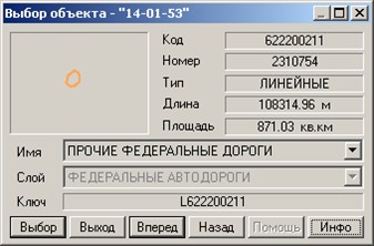
Dialog of selecting object:
Display of the object metrics (subobject) includes a number of statistical characteristics, and also its coordinates and schematic display. The following characteristics of object (subject) are displayed: -quantity of subjects in object; -number of a displayed subject (the object has number 0); -quantity of vertexes in object (subobject); -distance between the current vertex and the next vertex of object (subobject); -direction angle from the current to the next vertex of object (subobject).
Coordinates of the metrics can be displayed and edited in various units: -in meters in rectangular coordinate system; -in map units in rectangular coordinate system; -in pixels in rectangular coordinate system; -in radians in geodetic coordinate system; -in degrees in the geodetic coordinate system; -in degrees, minutes, seconds in the geodetic coordinate system.
At change of the object coordinates by change of distance and angle, coordinates of the vertex that follows the current one are corrected. The coordinates of the first point of the metric by this way can not be corrected. For editing heights in the metrics of object it is necessary to expand preliminarily a window of the help information about object. It can be done by pressing the right mouse button over the dialog and by selecting the item Full info in the pop-up menu, and also by double pressing the left mouse button over header of dialog. |