Export of ODNM to MIF format |


|
|
The open digital navigation map (ODNM) for motor transport is intended for the decision of navigation tasks of motor transport and contains the information about objects of district, about the organization of traffic, about objects of a roadside infrastructure and service, the address information. The digital navigation chart for motor transport can be converted into MIF format (MapInfo Interchange Format). For converting, select the directory, which contains ODNM in SXF format, and the classifier. The classifier should correspond to scale of convertible maps and to contain objects and the characteristics approved for digital navigation maps of open type. Classifiers for ODNM marked “open” in the filename of the classifier, delivered with the installation program kit, correspond to these requirements. Onto each layer of a navigation map 2 files are created with extension MIF and MID. All files are placed in one folder which has a name of an initial map. The kind of the conventional symbols formed in file MIF, can be changed by editing a text file with extension S2M which name includes a name of the classifier of creating a map and is placed in an installation folder with executed modules. For example, the customization file 25t05open.s2m corresponds to the classifier 25t05open.rsc. Each line of a customizing file contains the description of one symbol from the classifier. For example: P0012110000 SYMBOL (37,16711680,12,"Map Symbols",0,%.3f) P0022241000 SYMBOL (110,255,12,"MapInfo Miscellaneous",0,0) L0021300000 PEN (27,2,43775) T0091100000 FONT("Arial",0,0,0) S0022121000 PEN(1,6,5526780) BRUSH(1,0,0) P0012110000 - the unique identifier of object's kind in the classifier. The parameter "%.3f” is automatically replaced with angle's value of symbol turn. If the parameter is equal to zero all symbols will be displayed without turn. At writing into file MIF geodetic coordinates of objects from CS-95 will be converted to geodetic coordinates WGS-84 (“CoordSys Earth Projection 1, 104”) according to the order of transformation specified in GOST Р 51794-2007. The list of the attributes saved in file MID, corresponds to the list of the layer attributes specified in the classifier of a map. Additionally into the list of attributes the following attributes are placed: OBJECTNUMBER Integer - unique number of object; OBJECTCODE Char (32) - a code of object from the classifier; OBJECTLOCAL Integer - a code of object's localization (0 - line, 1 - polygon, 2 - point, 4 - vector); OBJECTNAME Char (32) - the object name.
For example: "1814";"71100000";"1";"WOOD VEGETATION";;;;;;;;;;;;;;;; "725";"61330000";"0";"FIELD AND WOOD ROADS";;;;;;;;;;;;;;;;;;;;;;;;
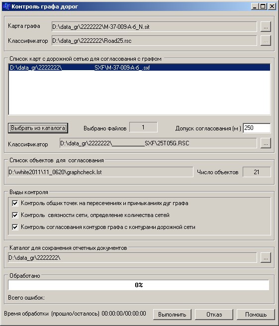
The dialog window looks like:
|