Import of data from format GML (XML)(Geography Markup Language) |


|
|
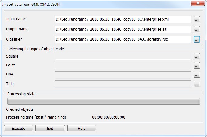
This program is intended to import data from format GML(XML) or geoJSON under the created schemes, that allows pre-testing the created XSD schemes for the completeness and correctness, and also for compliance of formed conventional symbols to the requirements of normative documents.
To perform the data loading process, it is necessary to choose a name of an input file with extension gml or json, to set a name of an output file in the format of GIS Panorama (sit or sitx), set the file name of the classifier rsc. The view of created linear, polygonal, point objects and titles can be assigned by selection from the classifier.
After finishing the import of data the map automatically opens in a new window. |