Panchromatic Merging of TIFF Rasters Using Rational Polynomial Coefficients (RPC) |


|
|
Panchromatic merging of TIFF rasters using rational polynomial coefficients (RPC).
The input data consists of TIFF images in the form of a set of files:
• Raster-MUX.tiff — multi-channel RGB image
• Raster-MUX.rpb — text file with rational polynomial coefficients (RPC)
• Raster-PAN.rpb — panchromatic single-channel image
• Raster-PAN.tiff — text file with rational polynomial coefficients (RPC)
The dataset contains two TIFF files for the same area: a high-resolution single-channel panchromatic image and a medium-resolution multispectral image. The incoming TIFF files do not contain information about the projection and image georeferencing. Automatic positioning of the images in the Panchromatic Merging task is achieved through the rational polynomial coefficients (RPC) from the *.rpb file. The rational polynomial coefficients (RPC) provide a compact representation of the geometry from the ground to the image. The coordinate system for the output raster is set to Latitude/Longitude on the WGS84 ellipsoid.
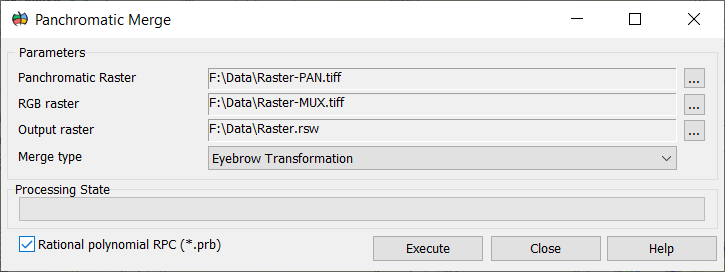
Type of dialog for Panchromatic Merging of TIFF Rasters Using Rational Polynomial Coefficients (RPC):
|

