Parameters formation of cadastral documents |


|
|
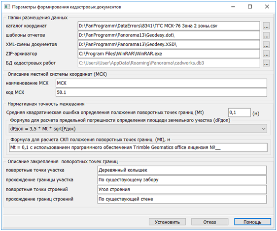
Information in the blocks Description of Local Coordinate System, Normative Survey Accuracy, and Description of Boundary Point Markers is used when filling out cadastral document report forms, in case the corresponding semantics are missing for cadastral objects.
Buttons at the bottom of the dialog are designed to perform project actions: — Set — saves the entered parameters. — Cancel and Help — standard Windows dialog responses.
The Data Placement Folders block contains: — Coordinate catalog — path to CSV file containing names and coordinates of reference survey network points. — Report templates — path to folder containing report templates in dot format. — XML document schemas — path to folder containing XML schemas for electronic cadastral documents. — Cadastral work database — path to DB3 format file containing information about completed cadastral works (contracts, clients, cadastral engineers, measurement equipment information, etc.).
Local Coordinate System (LCS) Description block — current name and code of the LCS used by the program to fill reports and electronic documents. Normative Survey Accuracy block — information about maximum allowable RMS error in determining coordinates of characteristic points and formulas used to calculate RMS errors of characteristic points and cadastral objects' area. Boundary Point Markers Description block — text values used when filling corresponding report columns and electronic document elements, when necessary values are missing in the semantics of characteristic points. |