Exporting a group of height matrices into TIFF and KMZ files |


|
|
During export, heights values from height matrices are saved into TIFF and KMZ files. Single-channel files with data about height of TIFF format with the information on a geospatial anchor are created. Parameters of projection and coordinate system of the source height matrix are entered into the formed GeoTIFF file. The parameters of the vertical coordinate system created in accordance with the height system of the source matrix are also written into the output file. GeoTIFF file for a vertical coordinate system stores the name of the vertical coordinate system, the height measurement units contained in the file, and other parameters.
Currently, the GeoTIFF file contains data for such height systems as: • «Baltic 1977 height (EPSG:5705)»; • «WGS 84 (geographic 3D) (EPSG :4327)»; • «MSL height (EPSG:5714)».
The saved KMZ file is an archive of a KML file with a set of single-channel GeoTIFF files with data on relief heights. The KM file contains a description of the data - the names of files with the coordinates of the height matrix binding, as well as the priority of their drawing.
Source matrices in MTW format files can contain heights in the following units: meters, decimeters, centimeters, millimeters. A matrix element can be written in the following formats: integer size 8 (BYTE), 16 (INT16), 32 (INT32) bits, real number 64 bits (FLOAT64). When building a matrix of heights using vector map data in GIS Panorama, the heights values are written in 32-bit integer format with a height accuracy of 1 millimeter. Matrices loaded from other formats can have a format from 8 to 64 bits with an accuracy of 1 millimeter to 1 meter. Application Summ elevation matrixes reduces the accuracy of elevation values to decimeters, centimeters, or meters. Reducing the accuracy allows you to reduce the size of the matrix in compressed form.
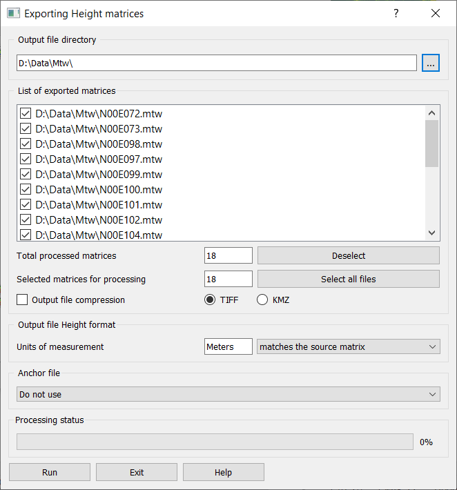
Based on this data, when saving the matrix to a TIFF file, the user can select the height format in the new file: BYTE, INT16, INT32, FLOAT32, FLOAT64. If the source height units are «decimeters», «centimeters», «millimeters», then to save heights in TIFF without loss, it is recommended to select the 32-bit real number format (FLOAT32). When selecting INT16 and INT32 formats, height values are rounded to whole meters (up). If the source height units are »meters», then it is recommended to save in 16-bit format. By default («By source matrix»), the height format in the new file is selected by the program so as to avoid reducing the height accuracy. When the «Output file compress» option is selected, the size of the TIFF file will be minimal.
The dialog is started on the «Matrixes» tab of the «Data list» dialog using the «Save as...» context menu item for the «Matrix» branch. |