Editor |


|
|
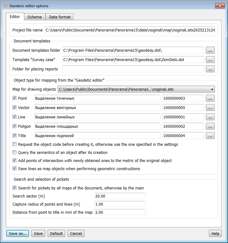
In the Document Templates group, the following is specified: — Template folder name is used when generating reports with selection from a list in various modes (traverse, direct and inverse problem, tacheometry, tie-in works, land boundary file formation and land plot description). — "Land Boundary File" template name is used in corresponding modes of the Land Boundary File Formation task when outputting reports using a generalized template. — Reports folder is used to save report files generated during formation when the Automatically save generated reports flag is set. The report filename is automatically generated by the program by combining the word "report" with a unique object number (e.g., report125.doc). If a file with the generated name already exists, saving is not performed, and a new Word document instance is simply created (e.g., Document1).
In the Object Types for Map Plotting group, object codes used in Geodetic Editor modes when plotting information on the map are specified. These modes are from the following panels: Object Creation, Geometric Constructions, Along-Object Constructions, Object Geometry Modification, Dimension Labeling.
The following parameters are specified in this group: — If the Request object code before creation flag is set, the program won't use codes specified in settings but will request it before each map object plotting. — The Request semantics when creating object element is designed to call the Object Creation dialog for entering semantic information during object creation. — If the Add intersection points to object element is checked, during automatic new object creation operations, new points are added to existing map objects at junction locations with new objects. Points are added not to all objects, but only to those participating in constructions, i.e., serving as information sources for construction. — During point object creation, you can create linear objects connecting the source point and new point. To create linear objects, check the Save lines during construction element.
In the Picket Search and Selection group, you can set the picket search zone width and search parameters. When the search across all document maps element is set to true, picket search and selection is performed on the main map and all background (user) maps connected to the document. If the element is not set, picket search occurs only on the main map. |