Satellite-based field recognition |


|
|
The Satellite-based field recognition mode
Dialogue view
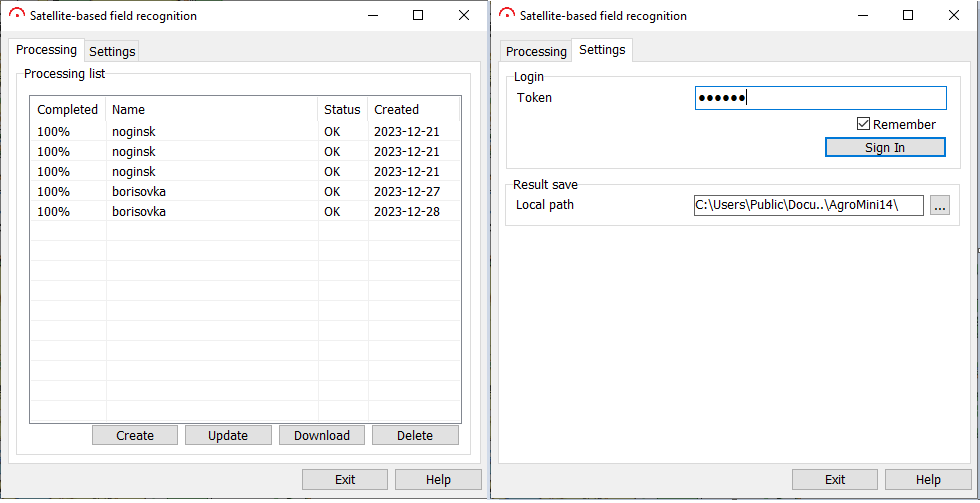
The mode dialog consists of a processing's control page and a options settings page. The options page allows you to log in to an external web service account and select a directory to download the results. The control page displays the list of account processing with current progress of execution, creation date, and contains controls for creating, deleting, loading of results and removal of processings. For recognition of fields contours it is necessary to create new processing for the chosen area of a current map by means of button Create, to track the termination of execution by means of button «Update», to choose processing in the list and to receive the list of objects in the form of a geojson-file by button Download, to import results by means of the mode Import data from GML (XML), GeoJSON. To gain access to the service, you need to register an account on the GeoAlert website and get a token to work through the API. For the correct work of task on the account of an external web service, in the project by default the «Fields Detection» model must be available.
|