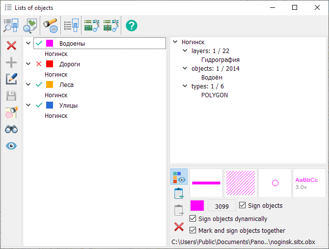
Lists of objects |
This mode are intended for saving criteria of marking objects of a map. Criteria are set by the filter or an any set of objects for all map sheets of the document. Lists of objects are saved in a file with OBX extension. The name of a file is formed by name a file of the basic document and is located in LOG subdirectory. Data of lists file can be used for an execution of operations above sets of objects: selection, union, intersection, search, signing and others.
Modes for creating and editing lists of objects
Editing the name of the list is carried out by clicking LMB in the tree of object lists. Operations on lists of objects
Creating and editing thematic layers
When creating a list of objects, a thematic layer is automatically formed with a set of conventional symbols for localization: areal, linear and vector (point).
There are 3 ways to assign a thematic layer view: 1. Default view, with the ability to change colors. A set of conventional symbols and color are formed automatically. 2. The view assigned in the map classifier, with the ability to replace the color. It is set using the Display as object view mode. 3. Custom view. Set using the Editing styles mode.
In order to change the color of conventional symbols, in the tree of object lists, click LMB in the area of the icon with the color.
The title of the thematic layer contains the name of the list and map. For example, List [Noginsk].
Labeling List Items
This mode is designed for labeling list items based on their semantic characteristics.
To label a list, follow these steps: 1. Enable the «Sign Objects» mode.
2. Choose a semantic characteristic. By default, the semantic «Proper Name» is selected. Hovering over the semantic code will display the name of the semantic characteristic in a tooltip.
To select a semantic characteristic, click the left mouse button in the area displaying the semantic code . In the «Semantics choice» dialog, you can choose the appropriate semantic for labeling.
If the object being labeled lacks a selected semantic or has no value, the object will not be labeled. The labeling style can be set by default, with color replacement, similar to thematic layers, or have a custom appearance. This is configured in the Editing styles mode. When the semantic code, color, or labeling style is changed, a relabeling of the list of objects is performed. Simultaneously displaying objects in lists with symbolic signs and labeling based on semantics is possible.
Dynamic Labeling of List Objects
This mode allows you to apply labels on top of the map taking into account the current map display and visibility of objects. Dynamic labeling is performed based on the dimensions of the client area of the window. To improve readability when scaling the map, such labels are always drawn while maintaining the font height selected by the user. When labeling an area object, the label is placed in the visible part of the polygon being labeled. When scrolling the map image, the label automatically shifts so that its text fits entirely within the client area of the window. For curved labels, it is not recommended to choose a background. It is recommended to choose highlighting around characters (Narrow outline).
To dynamically label list objects, you need to: - set the mode to Label Objects - select a semantic characteristic for labeling - set the mode to Label Objects dynamically
Example of dynamic labeling of lakes, streets, and highways
Example labeling streets based on the semantic characteristic "OSM Identifier"
Modes for creating and editing thematic layers
Composition of the list of objects Information about the composition of the list is presented in the form of a map tree with a description of the total and used number of objects, layers, localizations, semantics, measurements and formulas.
Examples of describing the composition of a list of objects
|