Building a polygon by a given azimuth and distance |


|
|
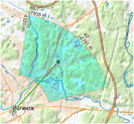
At the beginning of creating a search zone after activating the mode, you should specify a reference point on the map by clicking the left mouse button. Next, by moving the mouse cursor, the necessary direction and distance from the control point are set.
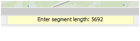
As the cursor moves on the polygon being formed, the values of all control values are displayed: azimuth and distance from the control point, as well as the parameters of the polygon being formed: the value of the search sector in degrees and meters (along the far arc), the width of the search zone and the maximum distance in the search zone from control point. The current distance from the control point is displayed in the dynamic parameter entry line:
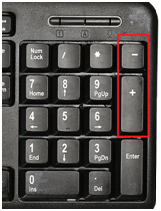
The distance value (in meters) can be entered using the keyboard while moving the cursor. Search zone parameters can also be changed while moving the cursor using the additional keyboard keys:
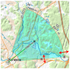
«+» and «-» - changing the width of the search zone, «Shift_+», «Shift_-» - changing the search sector. Pressing the left mouse button again performs a preliminary fixation of the search vector. At the same time, marks for controlling the parameters of the search zone appear on the contour of the zone.
You can fix the zone (write the object to the map) by double-clicking the left mouse button. If the document contains several maps available for recording, the program will offer a choice of the map to which the created polygon should be recorded.
|