|
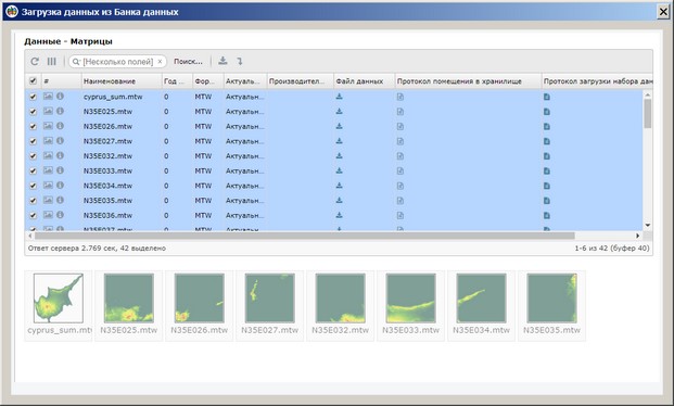
Loading data from the Database |


|
|
The task is designed to load data using the web interface of the Database (DB) in table mode. For downloading each type of data — maps, matrices, rasters — a separate item in the File menu is intended. Upon initiating the loading mode, execute the command to select an area on the open map. Considering the selected rectangular frame, the data is displayed in a tabular form and upon clicking the Download button, it is placed in the directory specified by the user (for locally stored maps). Standard directory for downloading data is utilized for maps from the GIS Server (e.g., C:/Users/username/Downloads).
To connect to the DB resources, the URL address of the Database location is used. When forming the address, the following parameters are taken into account: the base part with the IP address, the database table name (maps — t_md_map, matrices — t_md_matrix, rasters — t_md_image), data format (map, matrix, image), and coordinates of the frame for selection. The base part of the address should be configured in the Data Placement dialog (Options menu item) or used by default — spatialdb.net. The task is implemented for the Database version supporting table mode calls not lower than 8.7.0. |