Placing pickets along the route |


|
|
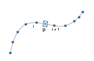
The system of linear coordinates defined by a route is used for search of a location and calculating coordinates of pickets by measurements on the route. To determine the location of the picket on the route, a search of the metrics segment (i, i+1) is carried out on which the picket is located.
Mi<MP<Mi+1
Calculation of planned coordinates of picket, at known measurement, is carried out according to the formulas:
XP = Xi + (Xi+1 - Xi) * (MP - Mi)/(Mi+1 - Mi),
YP = Yi + (Yi+1 - Yi) * (MP - Mi)/(Mi+1 - Mi)
XPYPMP - picket coordinates XiYiMi - coordinates of the i-th point of the route metric Xi+1Yi+1Mi+1 - coordinates of the i+1st point of the route metric
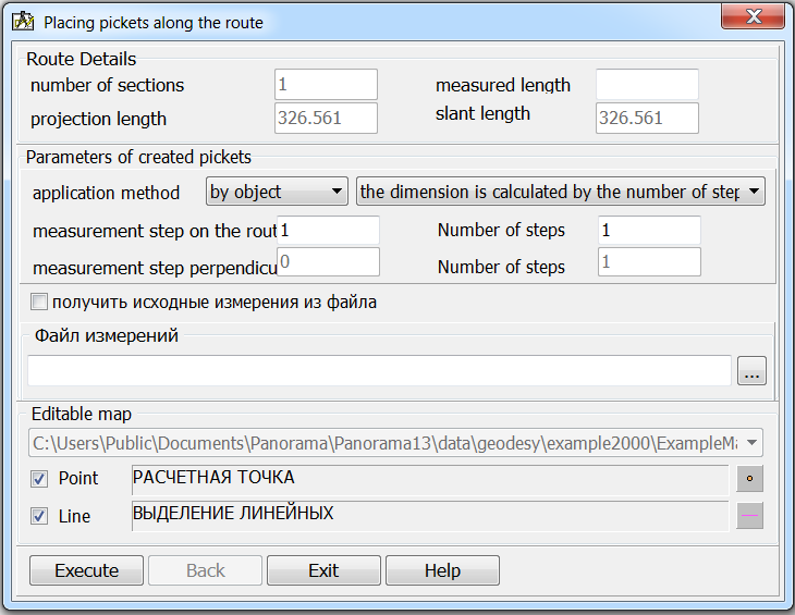
To perform calculations, it is necessary to select a route on the map and then, in the dialog, enter the necessary parameters for calculating the coordinates of pickets and drawing objects onto the map.
The mode supports the creation of pickets, both along the route and on a straight line perpendicular to the current segment of the route metric. It is possible to add pickets based on measurements from a CSV file containing information about pickets in the form of an SMLD string, where S - sequence number of the section (subobject) of the route. M - measurement of length within the section (subobject) of a route. L - measurement on a perpendicular to a route D - a direction for mapping (1-at the left, 2 to the right of a route) In a line of measurements the information about section, measurement on a perpendicular and a direction for mapping may be missing. The format of all lines must be the same. For example, all rows contain MLD fields or only M. |


