Use of the task «Downloading JPEG photos with GPS-coordinates onto a map» in the mode of "swivel assembly" at processing the materials of the survey obtained from UAVs |


|
|
The mode "swivel assembly" allows to process the materials of survey obtained from UAVs. The automatic binding and turn of the photo image by coordinates of the survey point and angle of the image direction from the appropriate EXIF-tags of file JPEG are performed. The mode is developed in interests of a national economy, for example, for the monitoring of pipelines, as well as in interests of power departments for reconnaissance. As a result of performing the given mode the objects are put onto a map: - Point objects in which semantics the reference to a snapshot file is written down. - Linear object - a trajectory of the UAV movement. - Closed linear objects - contours of rasters. - Into the map document there are added the geo-referenced rasters RSW.
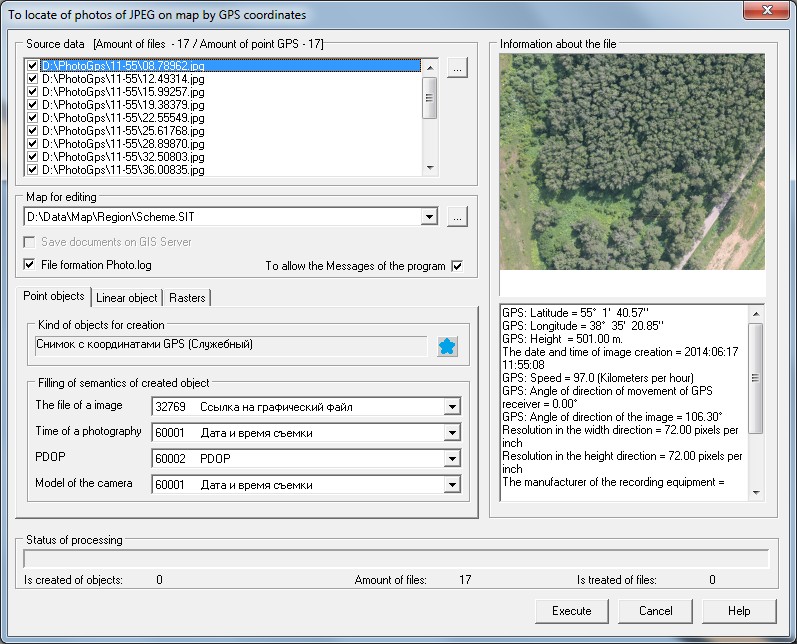
Bookmark «Point objects» As a result of mode execution onto a map the point objects are put in which semantics the reference to the snapshot file is written down. For one photo with GPS coordinates on a map the one object is created. During execution of the mode, photos are copied into the folder \PHOTO\, that is created in the folder of an edited map.
On the bookmark «Point objects» the kind of created point objects is specified and the filled semantics are selected from the list. ATTENTION: Semantics «The file of an image» is obligatory for filling which type should match the «Filename of the registered type».
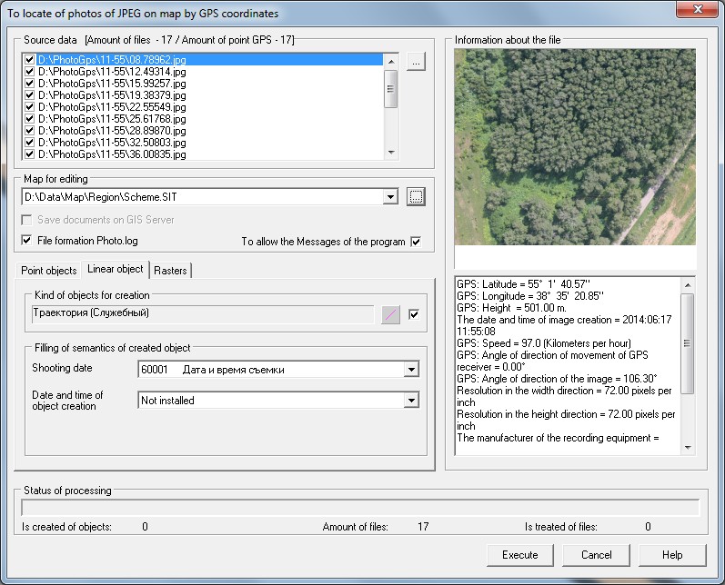
Bookmark «Line object» As a result of mode execution onto a map the line object is put, consistently connecting the points with GPS coordinates from processed images. For group of processed images on a map the one object is created.
On the bookmark «Line objects» the kind of created line object is specified and the filled semantics are selected from the list.
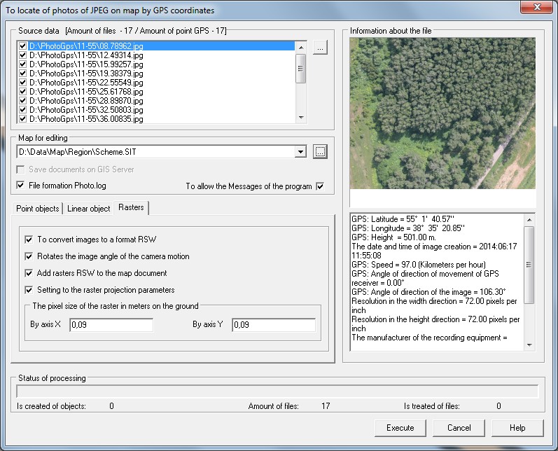
Bookmark «Rasters» On the bookmark «Rasters» the conversion of images JPEG is included into files of format RSW c possible turn of the image by angle of the image direction, specified in the corresponding EXIF-tag of the source file. The downloaded rasters RSW receive a geo-binding and are added into the map document.
The pixel size of the raster in meters on the terrain is set by the operator in accordance with the technical characteristics of the equipment installed on the UAV, and to the survey conditions. |