Build matrix of layers |


|
|
Input data for building a matrix of layers are the legend of a matrix and the database of geological measurements formed by modes «Soil description» and «Bore creating» of tasks «Engineering-geological column». Database of geological measurements includes DBF-tables of the bore-holes description and descriptions of the bores soils.
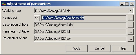
The name of an input DBF-file of the description of bores is set at setup of the task parameters «Engineering-geological column» in a window Description of bore.
The name of input DBF-file of the bores description is displayed in group Input data of dialog of a matrix creation. At creation of a matrix it is used also the DBF-file of soil description of bores which name is formed of a filename of the description of bores with addition «_layers», for example: bore4.dbf - a file of description of bores, bore4_layers.dbf - a file of soil description of bores.
Example of the contents of DBF-file of bores description bore4.dbf:
At creating matrix of layers the fields are used: - NUMBERBORE (bores number); - X, Y, H (coordinates of a bore); - COUNTLAYER (quantity of bore layers).
Example of the contents of DBF-file of soil description of bores bore4_layers.dbf:
At creating a matrix of layers the fields are used: - NUMBERBORE (number of bore); - THICKNESS (thickness of a soil layer); - KEYSOIL (a key of a soil).
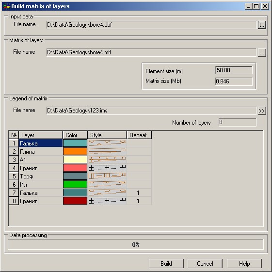
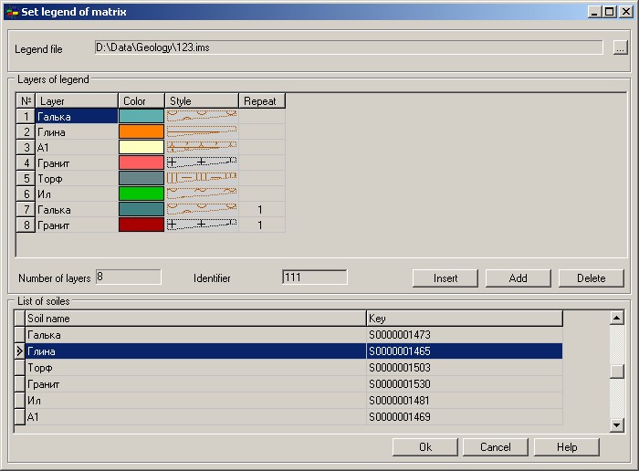
The name of a MTL-file of a created matrix and the size of an element are set in Matrix of layers group. Set a legend of matrix is called by pressing the button «>> » in the Legend of matrix group. The file of a legend has IMS extension. After setup of a legend the name of IMS-file is entered into section [GEOLOGY] of an INI-file of the document by LegendFile key. If the file of a legend specified in an INI-file of the document, exists, its contents are displayed in the Legend of matrix group of dialog Build matrix of layers.
|