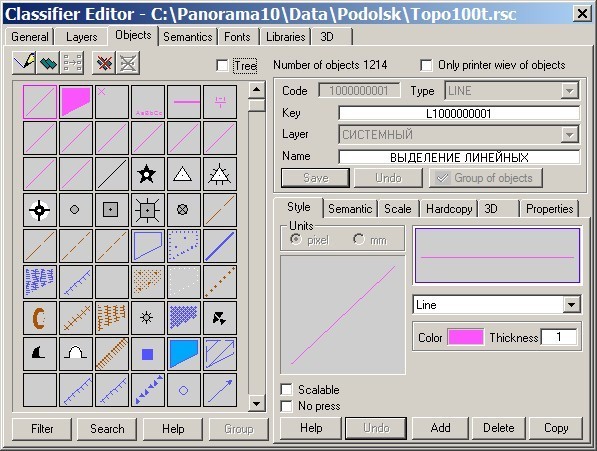
Setup of map classifier |

|
|
The majority of modes and tasks of the geodetic block function according to the installed parameters. So for mapping from modes of calculated geodetic tasks (a theodolitic course, direct and return geodetic tasks, a tacheometry, setting works) are used the codes of objects specified on "Calculations" page in dialogue «Parameters of the project …». The codes of objects specified on "Editor" page are used at creation of objects by means of the Geodesy editor. At formation of the scheme for the report the codes of objects from "Scheme" page are used. Except for that at filling of the reports the technique of search of the corresponding values by conformity of names of key fields of a pattern and short names of semantics is used. Order of setup and names of keys of objects and the semantic characteristics used by programs of the geodetic block are shown below. For work of programs from structure "Geodetic tasks" presence of some the objects used at mapping and formation of reports is necessary. In the map500.rsc classifier for these purposes the layer "GEODESY" is created. It includes the following objects:
It those objects which it is necessary to specify in option parameters of an execution of this or that geodetic task. If necessary the user can execute any other settings at own discretion. However a number of functions of the program thus can be lost. For example, in system there is an opportunity of formation the scheme of a plot with various registration by structure for filling one report. For this purpose the program creates the scheme with the maximal structure of registration (the titles of points, coordinates, coordinate crosses, etc.) and places it on the screen for the subsequent editing. When editing is ended, there is a formation of the several figures (picture) corresponding to various registration. These figures correspond to key fields in a pattern of the report. PICTURE - full structure of registration; PICTURE1 - to switch-off titles of coordinate crosses; PICTURE2 - to switch-off the crosses of coordinate and their titles; PICTURE3 - to switch-off titles of lines; PICTURE4 - to switch-off titles of crosses and lines; PICTURE5 - to switch-off crosses, titles of crosses and lines. If in parameters to not specify various types of titles for various objects of settings, and to choose, for example, one type of the title for all options the program will incorrectly generate the image of the scheme. Types of objects specified in the table are used by the program for automation of process of setting up of the project by "Default" button. The principle of automatic setting up consists in search of the corresponding objects by a key. If you use other classifiers of a map then for automatic setting up of the project it is necessary to set at objects used by you the keys according to specified in the table. For these purposes the task «Editing of the classifier» is used.
For polygon object "PLOT" the set of semantics is stipulated (see tab. 1), corresponding to fields of the information for surveying affair: The important information in the classifier is the key of semantics, because by this characteristic the program carries out search in patterns of reports of places where it is necessary to insert the attributive information. Setting up in the classifier map500.rsc are executed so that semantics of objects (their keys) coincided with names of fields in the table "Registration data" and accordingly with key fields in patterns of accounting documents. Using the given options (setting up) it is possible to carry out accumulation of the attributive information about plots not in the table of a database, and in semantics of objects on an electronic map. In "Geodesy editor" for formation of the report on semantics "To generate the scheme on semantics of object" the mode from structure of the panel "Formation of reports" is intended.
Note: T/C - THEODOLITIC COURSE The user can independently execute setting up of any classifier, having set necessary names of keys of semantics. It is possible to expand the list of attributive characteristics, simultaneously with it having added key fields into patterns.
| |||||||||||||||||||||||||||||||||||||||||||||||||||||||||||||||||||||||||||||||||||||||||||||||||||||||||||||||||||||||||||||||||||||||||||||||||||||||||||||||||||||||||||||||||||||||||||||||||||||||||||||||||||||||||||||||||||||||||||||||||||||||||||||||||||||||||||||||||||||||||||||||||||||||||||||||||||||||||||||||||||||||||||||||